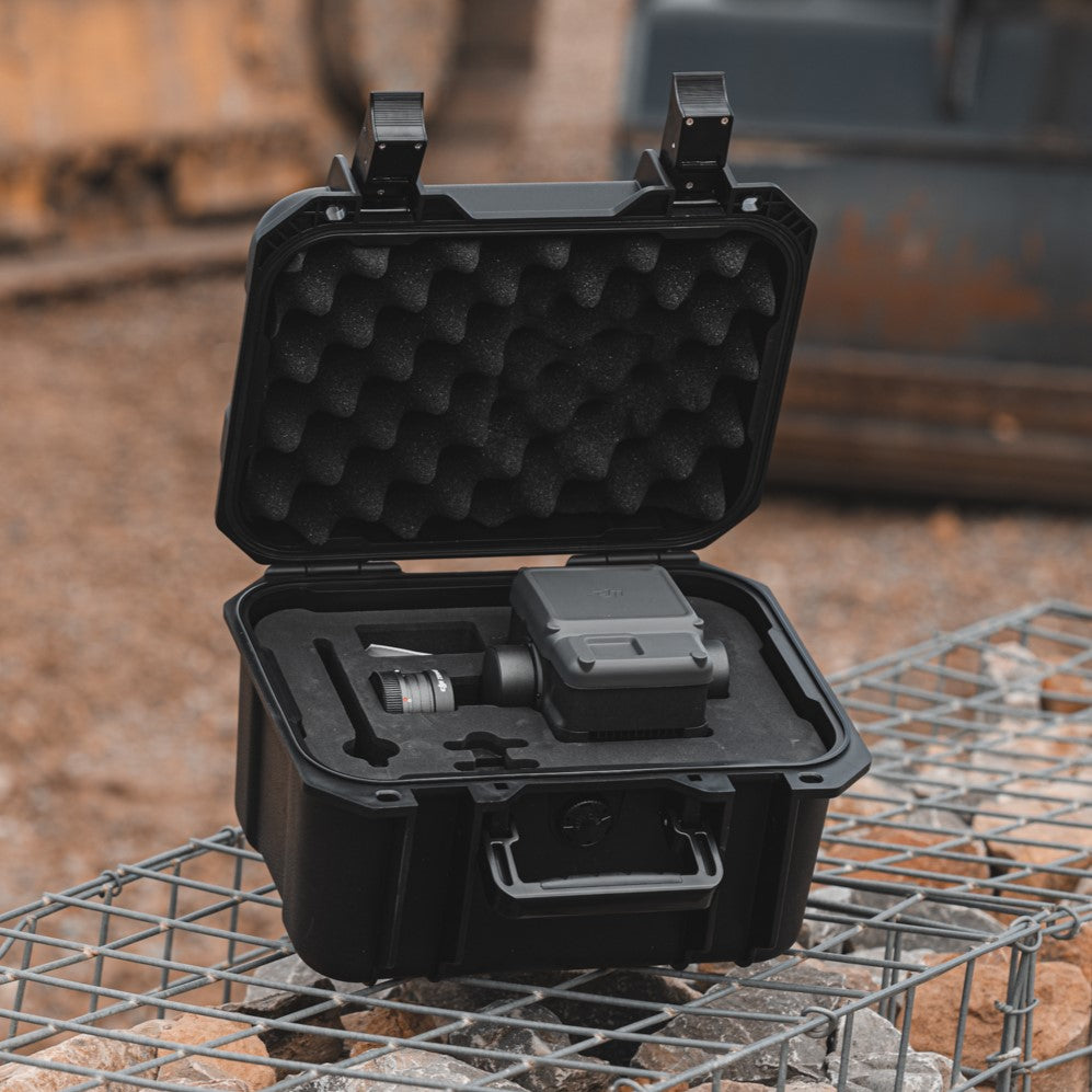
DJI Zenmuse L2 LiDAR + RGB Sensor
Zenmuse L2 In Flight
Close Up DJI Zenmuse L2 LiDAR Sensor
Zenmuse L2 In Case
DJI Zenmuse L2 LiDAR Sensor On DJI Drone

DJI Zenmuse L2

SKU: CB.202309210737

£11,341.00 Regular price
/
Tax included in UK  & Free Delivery
Notify Me When Available
Currently 5+ units in stock.

What's in the Box

Take a look

Updated on variant change.

Explore what's inside the box.

Need advice on this product?

Ask a Question

Our experts are on hand to help you.

When You Spend £99

Free Next Working Day Delivery

Saturday Delivery Also available.

DJI Zenmuse L2

Accurate LiDAR and photogrammetry payload

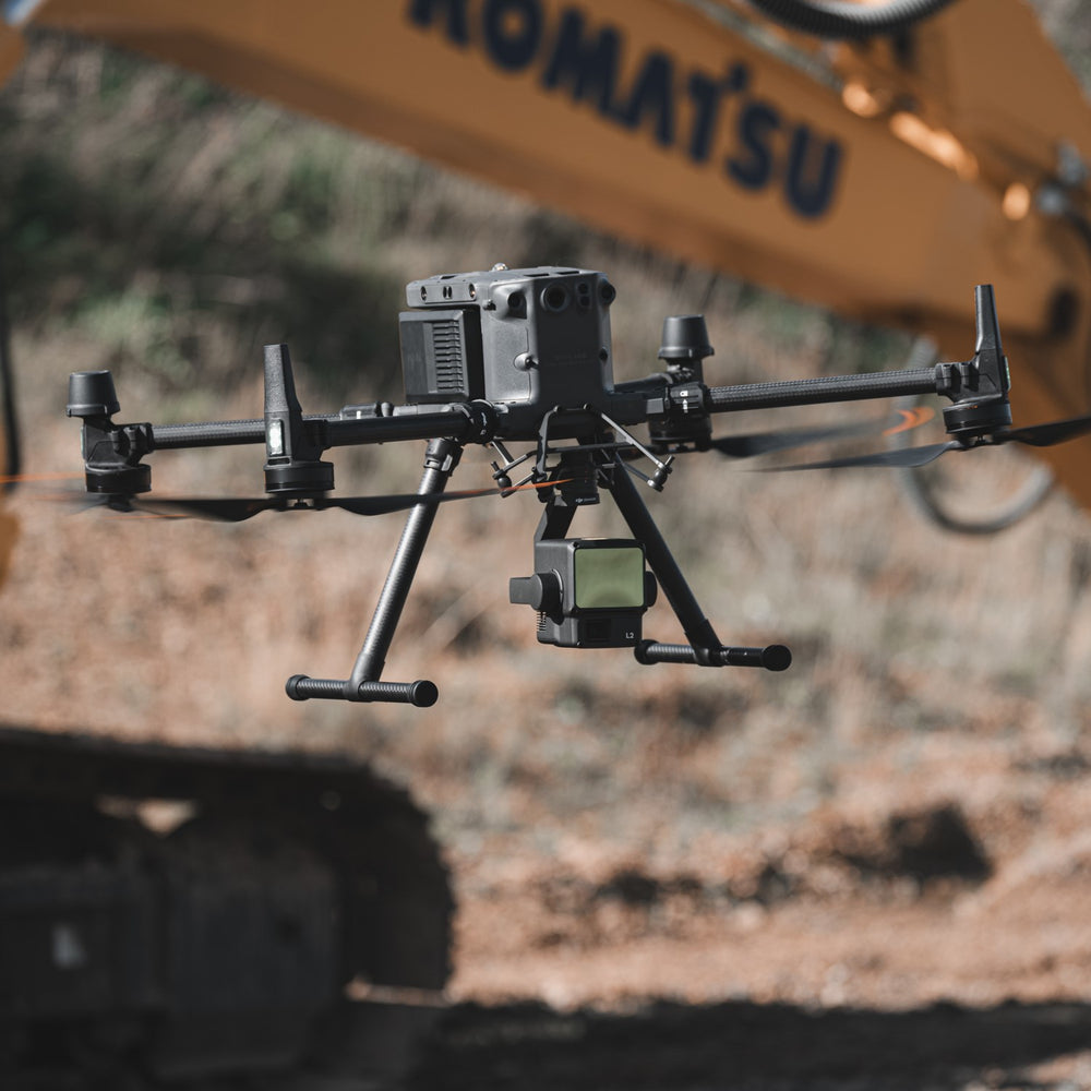
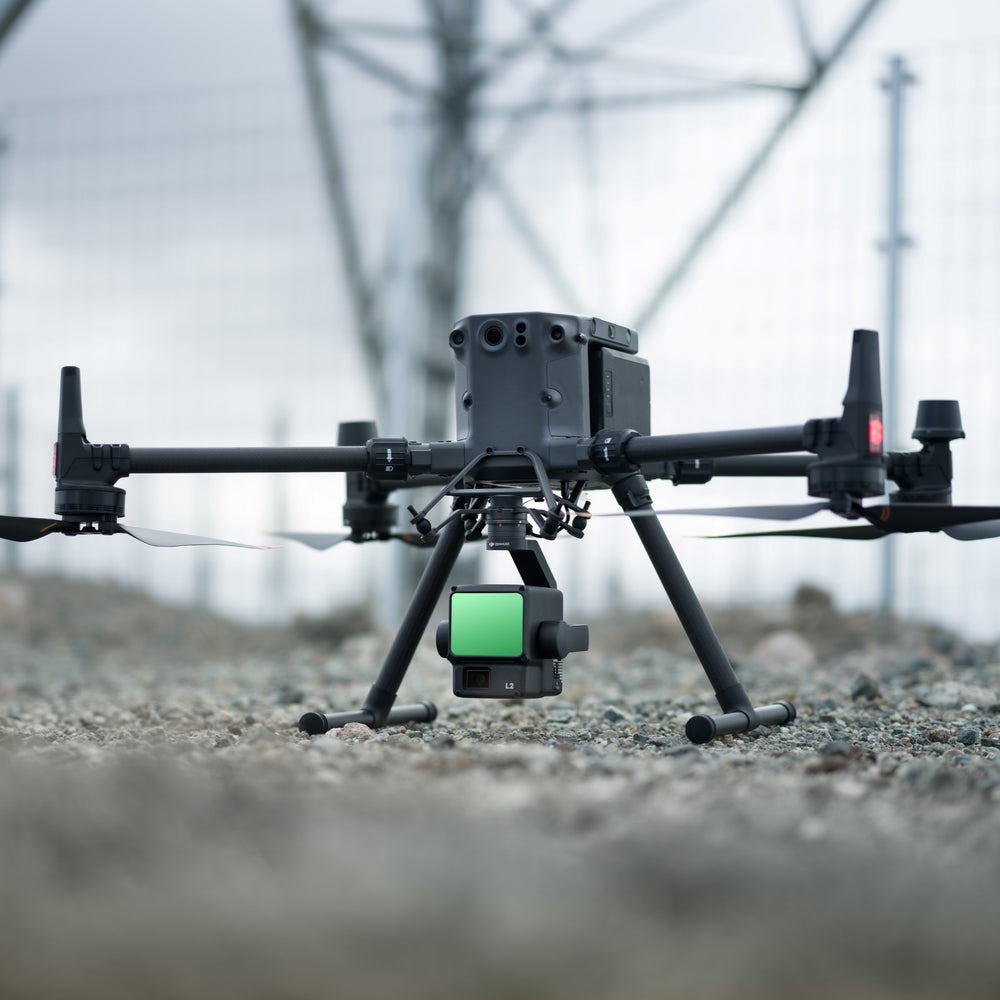
The DJI Zenmuse L2 is a highly-accurate and efficient drone surveying payload.

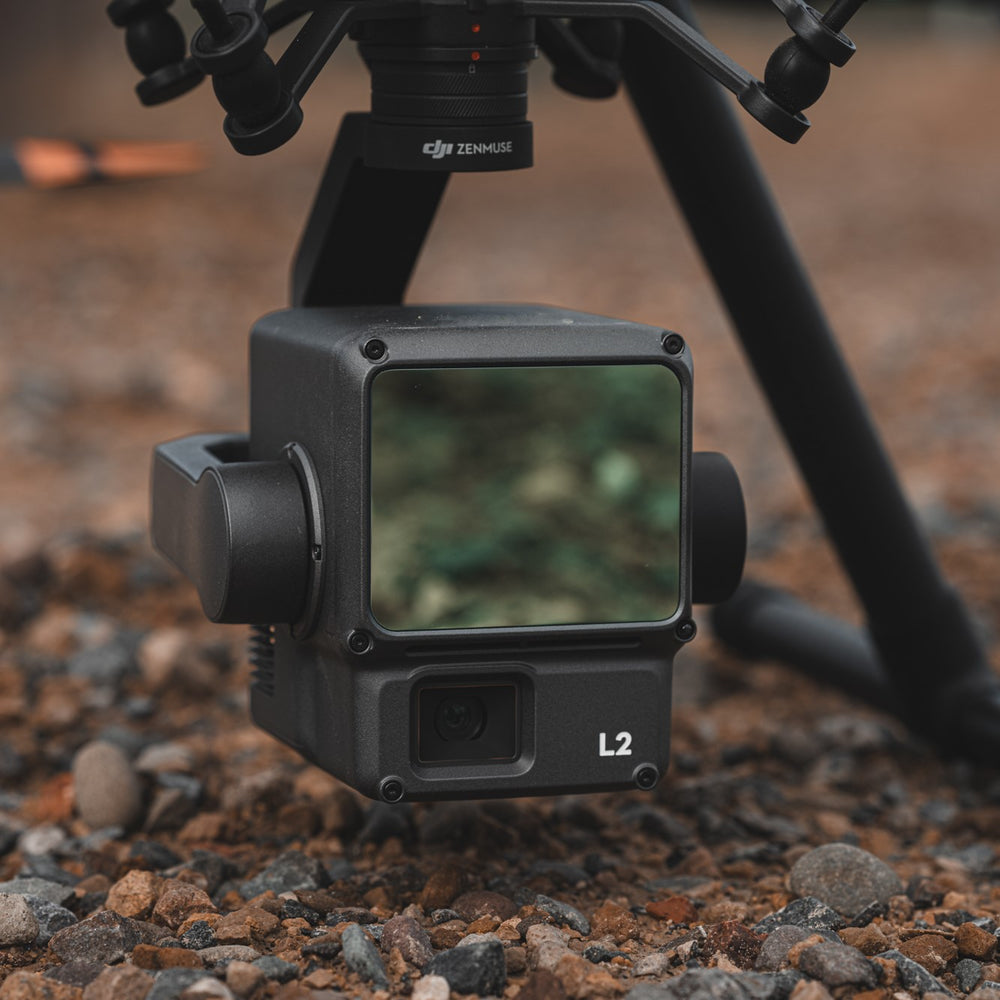
It integrates a LiDAR module, a high-accuracy IMU, RGB camera, and a 3-axis stabilised gimbal system.

The L2 supports up to 5 returns and has a maximum multiple return rate of 1,200,000 pts/s - capturing the details of complex structures and delivering centimetre-accurate reconstructions.

The 4/3 CMOS 20MP RGB mapping camera can be used for photogrammetry and for creating true colour point clouds.

Integrate the L2 with the DJI M350 RTK or the DJI M300 RTK (with the DJI RC Plus controller).

The L2’s IP54 rating allows it to be operated in wet or foggy environments. Also collect data at night.

Benefit from an enhanced workflow, with features such as Point Cloud LiveView and Quality Report.

Deploy the L2 across a range of industry verticals, such as energy, AEC, forestry, and public safety.

The L2 is a substantial upgrade compared to its predecessor, the L1, with higher sampling rates compatible with higher returns, a larger RGB sensor, and increased surveying efficiency.

L2 Dataset Examples

Exclusive datasets captured by heliguy™.


Powerline Reconstruction

The L2 is able to detect small objects during a survey - as shown by this vertical cross-section of power lines and transmission towers.


Vegetation Penetration

The L2 is able to better penetrate the tree canopy and capture accurate ground detail, as shown by this point cloud cross-section.


2D Orthomosaic

The RGB camera can be used for photogrammetry, such as creating detailed 2D orthomosaics.


RGB Point Cloud

These side-by-side images show how the L2 can create a more detailed RGB point cloud, compared to the L1.

A study at the site to compare the accuracy showed the L2 achieved an absolute vertical error of 44mm, compared to 51mm using the L1. Both were flown at 50m flight altitude.


LiDAR Module

The L2 offers up to five returns, with a maximum return rate of 1,200,000 points per second, and has a laser pulse emission efficiency of 240kHz.

It enables the L2 to easily generate accurate elevation data in dense forest fields and extract it into DTMs, as well as detect small objects on a survey site and map complex structures.

  • Detection Range: 450m @ 50% reflectivity, 0klx; 250m @ 10% reflectivity, 100klx.
  • Point Cloud Rate: Single Return Max - 240,000 pts/s. Multiple returns, max 1,200,000 pts/s.
  • Scanning Modes: L2 has non-repetitive scanning pattern and repetitive scanning pattern. This increases the likelihood of objects and other details being detected within the FOV.
  • 5 Returns: Up to 5 returns @ 240kHz.
  • More Concentrated Energy: Smaller beam size - laser spot size is 4 x 12cm @ 100m, 1/5th of the L1.
  • Highly Accurate: Horizontal 5cm @ 150m flight altitude; Vertical: 4cm @ 150m flight altitude.
  • Efficient: Collect data while flying at up to 15m/s. Cover up to 2.5km-squared in a single flight.
  • LiDAR Module - Ranging Accuracy: 2cm @ 150m, compared to 3cm @ 100m on the L1.
  • Laser Ranging: Supported, up to 450m.

RGB Camera

The RGB camera can be used for photogrammetry.

It also allows the L2 to output reality models and true colour point clouds, including real-time point cloud colouring (with parameters of Reflectivity, Height, Distance, RGB).

Use the RGB camera to capture video, as well as still imagery.

Key features of the RGB camera include:

  • 4/3 CMOS sensor
  • 20MP
  • 84° FOV
  • Mechanical shutter (to eliminate rolling shutter blur), high-speed burst with 0.7s interval
  • 4K @ 30fps video

High-accuracy IMU

The L2's high-accuracy IMU (inertial measurement unit) is essential for quality LiDAR data collection.

  • Yaw Accuracy: Real-time 0.2°, post-processing, 0.05°.
  • Pitch/Roll Accuracy: Real-time 0.05°, post-processing, 0.025°.
  • Horizontal Positioning Accuracy: RTK FIX: 1cm + 1ppm.
  • Vertical Positioning Accuracy: RTK Fix 1.5cm + 1 ppm.

As a bonus, the IMU on the L2 does not require a warm-up, and is ready to operate after start-up.

One-stop Processing

Process L2 data through DJI Terra.

The L2 includes a DJI Terra licence for point cloud data processing, including pre-processing and post-processing point cloud functions.

DJI Terra supports exporting point cloud models in the following formats:

  • PNTS
  • LAS
  • PLY
  • PCD
  • S3MB

DJI Terra updates - such as added support for generating a DEM for LiDAR point cloud reconstruction, ground classification for LiDAR data; and automatic GCP marking - provide a more seamless and comprehensive workflow.

After processing through DJI Terra, the data can be imported into third-party software, such as DJI Terrasolid, for further manipulation and analysis.

L2 vs L1

L2 provides significant upgrades for surveying

The L2 is an upgraded version of the L1. Key upgrades include:

  • More Efficient Payload: Does not require 5-10 minute period for IMU warm up, which is needed when using the L1.
  • Accuracy At Speed: Accurately capture data at 15 m/s flight speed. Recommended flight speed for L1 is aroud 8 to 13 m/s.
  • Improved Return Pulse: L2’s maximum return pulse is Penta, as opposed to L1’s Triple return, resulting in improved ability to scan through areas of vegetation and capture complex structures.
  • Higher Sampling Rates: Higher sampling rates compatible with higher returns: L2’s pulse rate is 240 kHz with 5 returns, L1 achieves 160kHz with Triple-echo mode.
  • Increased Accuracy: Greater absolute accuracy compared to the L1 sensor.
  • Denser Point Clouds: The ground point density of the L2 is more than 3 times that of the L1.
  • Upgraded RGB Sensor: L2 has a 4/3 CMOS sensor and 0.7s shooting interval, compared to L1’s 1-inch sensor and 2 second (minimum) shooting interval.

For a full comparison between the two payloads, including side-by-side datasets, read our in-depth L2 vs L1 blog by clicking the button below.

Product specification

DJI Zenmuse L2

Specification Value
General
Dimensions (L×W×H) 155 x 128 x 176 mm
Weight 905±5 g
Power 28 W (typical)

58 W (max)
IP Rating IP54
Supported aircarft Matrice 300 RTK (requires DJI RC Plus)

Matrice 350 RTK
Storage Temprature -20°C to 60°C (-4°F to 140°F)
System Performance
Detection range 450m @50% reflectivity, 0klx;

250m @10% reflectivity, 100klx;

Typical data. Measured using a flat subject with a size larger than the laser beam diameter, perpendicular angle of incidence, and an atmospheric visibility of 23 km. In low-light environments, the laser beams can achieve the optimal detection range. If a laser beam hits more than one subject, the total laser transmitter power is split, and the achievable range is reduced. The maximum detection range is 500 m.
Point Cloud Rate Single return: Max: 240,000 pts/s

Multiple returns: Max: 1,200,000 pts/s
System Accuracy Horizontal: 5 cm @ 150 m

Vertical: 4 cm @ 150 m

Measured under the following conditions in a DJI laboratory environment: Zenmuse L2 mounted on a Matrice 350 RTK and powered up. Using DJI Pilot 2’s Area Route to plan the flight route (with Calibrate IMU enabled). Using repetitive scanning with the RTK in the FIX status. The relative altitude was set to 150 m, flight speed to 15 m/s, gimbal pitch to -90°, and each straight segment of the flight route was less than 1500 m. The field contained objects with obvious angular features, and used exposed hard ground check points that conformed to the diffuse reflection model. DJI Terra was used for post-processing with Optimise Point Cloud Accuracy enabled. Under the same conditions with Optimise Point Cloud Accuracy not enabled, the vertical accuracy is 4 cm and the horizontal accuracy is 8 cm.
Real-Time Point Cloud Coloring Coding Reflectivity, Height, Distance, RGB
LiDAR
Maximum Returns Supported 5
Scanning Modes Non-repetitive scanning pattern;

Repetitive scanning pattern
FOV Repetitive scanning pattern: Horizontal 70°, Vertical 3°

Non-repetitive scanning pattern: Horizontal 70°, Vertical 75°
Laser Beam Divergence Horizontal 0.2 mrad, Vertical 0.6 mrad

Measured at full width at half maximum (FWHM) conditions. 0.6 mrad signifies that for every 100m increase in distance, the diameter of the laser beam expands by 6 cm.
Laser Wavelength 905mn
Laser Spot Size Horizontal 4 cm, vertical 12 cm @ 100 m (FWHM)
Laser Pulse Emission Frequency 240 kHz
Laser Safety Class 1 (IEC 60825-1:2014)
Inertial Navigation System
IMU Update Frequency 240 Hz
Accelerometer Range ±6 g
Angular Velocity Meter Range ±300 dps
Horizontal Positioning Accuracy RTK FIX: 1 cm + 1 ppm
Vertical Positioning Accuracy RTK FIX: 1.5 cm + 1 ppm
RGB Mapping Camera
Sensor 4/3 CMOS, Effective Pixels: 20 MP
Lens FOV: 84°

Format Equivalent: 24 mm

Aperture: f/2.8-f/11

Focus Points: 1 m to ∞ (with autofocus)
Shutter Speed Mechanical Shutter: 2-1/2000 s

Electronic Shutter: 2-1/8000 s
Shutter Count 200000
Photo Size 5280×3956 (4:3)
Still Photography Modes Single shot: 20 MP

Timed: 20 MP

JPEG Timed Interval: 0.7/1/2/3/5/7/10/15/20/30/60 s

RAW/JPEG + RAW Timed Interval: 2/3/5/7/10/15/20/30/60 s
Video Codec and Resolution H.264

4K: 3840×2160@30fps

FHD: 1920×1080 @30fps
Gimbal
Stabilisation System 3-axis (tilt, roll, pan)
Angular Vibration Range 0.01°
Mounting Detachable DJI SKYPORT
Mechanical Range Tilt: -143° to +43°

Pan: ±105°

Structural limit, not controllable range.
Controllable Range Tilt: -120° to +30°

Pan: ±90°
Data Storage
Supported microSD Cards microSD: Sequential writing speed 50 MB/s or above and UHS-I Speed Grade 3 rating or above; Max capacity: 256 GB. Use the recommended microSD cards.
Post-Processing
Supported Software DJI Terra
Data Format DJI Terra supports exporting point cloud models in the following formats: PNTS/LAS/PLY/PCD/S3MB