

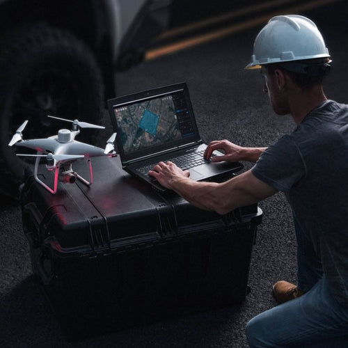
- DJI's Terrain Follow mode can benefit drone surveying operations;
- Terrain Follow can increase the accuracy of data collection, especially across a large survey site which has substantial elevation changes;
- Terrain Follow can be used on DJI Enterprise drones, such as the Mavic 3 Enterprise Series and the M300 Series;
- This blog highlights the range of Terrain Follow methods and explains the workflow for each.
DJI's Terrain Follow provides several advantages when conducting drone surveying.
This mode enhances the efficiency, safety, and accuracy of drone mapping missions by adapting to the terrain, avoiding obstacles, maintaining smooth flight paths, simplifying mission planning, and improving data quality.
Terrain Follow is available for a range of DJI platforms and is particularly suited for mapping with drones such as the Mavic 3 Enterprise Series, M300 Series, and the M30 Series.
This blog explores the benefits of deploying Terrain Follow and the associated workflows.
What Are The Benefits Of DJI Terrain Follow Mode For Data Capture?
Using Terrain Follow during drone flights has several benefits. These include:
1: Terrain Adaptation
Terrain Follow allows the drone to maintain a consistent altitude above the ground, even if the ground level is not uniform.
This is particularly useful in areas with varying terrain, such as hilly or mountainous regions.
By adapting to the terrain, the drone can capture images or data at a more consistent and accurate altitude, resulting in better-quality mapping outputs.

2: Smooth Flight Paths
When mapping an area, it's crucial to ensure that the drone follows a smooth and consistent flight path.
Terrain Follow helps achieve this by automatically adjusting the drone's altitude to match the ground level. This results in more uniform image or data capture, reducing distortions and inconsistencies caused by varying altitudes.
3: Simplified Mission Planning
Make mission planning easier and efficient by using Terrain Follow mode.
Instead of manually setting and adjusting the drone's altitude throughout the flight, set the desired height above ground level and let the drone handle the rest.
This simplification saves time and reduces the chances of human error during mission planning and execution. This can also improve safety during the flight.
4: Improved Data Accuracy
Maintaining a consistent altitude above the terrain contributes to improved data accuracy in mapping applications, including obtaining a more consistent Ground Sampling Distance (GSD). Read our guide to Ground Sample Distance And How It Impacts Drone Surveys for more information on GSD.
When the drone flies at a constant height, the distance between the camera/sensor and the ground remains relatively consistent, resulting in more precise measurements and data collection.
This is particularly important when generating 3D models, orthomosaic maps, or conducting topographic surveys.

Terrain Follow With DJI Drones
There are three Terrain Follow options to choose from when surveying with DJI Enterprise drones.
These are:
- Real-time Terrain Following
- Downloading a DSM from the internet
- Importing your own DSM
DSM stands for Digital Surface Model and provides a base for Terrain Follow missions. Read our Drones And DEMs vs DTMs vs DSMs blog to find out more about DSMs.
1: Real-time Terrain Following
The most simple method is Real-time Terrain Following. However, at this stage, this option is only available on the DJI Mavic 3 Enterprise Series drones.
This function utilises the obstacle avoidance sensors to accurately understand the drone's altitude above ground. And no internet connection is required.
To enable this, toggle 'on' under the Terrain Follow option...

...and choose Real-time Follow.

The benefits of using Real-time Terrain Follow are:
- No DSM of the site is required before flight.
- No connectivity to the internet is needed to pull through the DSM.
There are a couple key points on Real-time Terrain Follow to highlight.
Firstly, Real-time Terrain Follow currently supports flights from 80 to 200 metres.
If flying more than 200 meters above ground level, it is recommended to use the new in-app feature to download the global geoid file.
For flights below 80 metres, it is recommended to import a high-precision DSM file which can be generated by DJI Terra after one flight.
| AGL (Above Ground Level) | Mode |
| <30m | High-precision DSM file |
| 30-200m | Real-time Terrain Follow |
| >200m | In-app Feature and Global Geoid File |
Secondly, division systems cannot recognise very thin objects, such as power lines, so the drone cannot follow such objects.
Additionally, this method is not suitable for flights above water as a live terrain feature will not be able to generate an accurate DSM.
It's also not suitable when the terrain slope is greater than 75 degrees and it's not suitable when the light is insufficient.
2: Download From Internet
The second option for Terrain Follow is by using the download from the internet option when importing a DSM.
This method pulls the DSM from the internet to use instead of requiring your own DSM of the site.
For this method, toggle the Terrain Follow feature 'on' and select DSM Follow...

...and then select your DSM file, tap on the plus button in the upper right, and then select 'download from internet' and pull the DSM from the cloud.

In this example, the source for the DSM was from ASTER GDEM V3 with a resolution of 30 metres.

Advantages of this method are:
- No DSM required of the site before flight.
- Fly much lower than Real-time Terrain Follow.
However, some disadvantages of this method are:
- Low resolution of DSM at 30 metres.
- Inaccuracy and age of the DSM.
3: Traditional Import
The third Terrain Follow option is the traditional import: Importing a DSM into the DJI Pilot 2 app.
For this, the site will need to have been surveyed previously, and the surface model from the site will need to be loaded into a MicroSD card and inserted into the controller.
Then, toggle the Terrain Follow feature 'on' and select the DSM Follow.

...then select the DSM file and tap on the plus button in the upper right...

...then choose a file for the DSM, and then select the DSM file in a tiff file format from the microSD card and watch the flight plan adjust for elevation changes.

If using this method, it is important that your DSM file is 20MB or smaller, and has a spatial resolution of less than 10 metres.
Other considerations are:
- Utilise WGS 84 or EPSG Code 4326 for the coordinate reference system;
- Vertical datum for elevation data should be ellipsoidal. This mode is more tedious, but is the most accurate Terrain Follow method, as it allows lower flights than Real-time Terrain Follow.
One additional note, if the goal is a Waypoint Mission instead of a Mapping Mission you can plan the Waypoint Mission on DJI FlightHub 2 and adjust the waypoints to the terrain to keep the same elevation off the ground.

Types Of Missions That Support Terrain Following
The table below shows DJI's most recent enterprise drones and the type of Terrain Following missions they support.
| 2D Mapping | Smart Oblique | Oblique | Linear | |
| Mavic 3 Enterprise DSM Following | ✓ | ✓ | ✓ | ✓ |
| Mavic 3 Enterprise Real-time Terrain Following | ✓ | ✓ | x | ✓ |
| Mavic 3 Thermal DSM Following | ✓ | x | ✓ | ✓ |
| Mavic 3 Thermal Real-time Terrain Following | ✓ | x | x | ✓ |
| Mavic 3 Multispectral DSM Following | ✓ | ✓ | ✓ | ✓ |
| Mavic 3 Multispectral Real-time Terrain Following | ✓ | ✓ | x | ✓ |
| M30 Series DSM Following | ✓ | x | ✓ | ✓ |
| M300 Series DSM Following | ✓ | ✓ (only with P1) | ✓ | ✓ |
DJI Terrain Follow: Summary
Terrain Follow can be an important feature for drone surveying operations - especially for mapping projects on sites that have large elevation changes.
In these cases, planning a flight based solely on the height above the home location can cause inaccurate or insufficient overlap, result in varying levels of GSD, and potentially cause the drone to fly into the ground or object.
Therefore, depending on the mission at hand, Terrain Follow can become a crucial feature to help increase the accuracy and safety of data collection, which in turn helps to create more robust and reliable digital assets.
heliguy™ has an in-house surveying team. To discuss drone surveying workflows, or to find out how heliguy™ can help you start or scale your surveying programme, contact us.


Leave a comment