

- Check out highly-detailed 3D model of heritage asset, as captured by the P1 photogrammetry camera;
- Experts will use the high-resolution model as part of important maintenance plans, as well as heritage asset documentation;
- Survey completed in less than a day and offered a safe and cost-effective method of collecting data, especially accessing hard-to-reach areas on the historic gatehouse;
- The high-resolution model is particularly useful for up-close inspection, providing rich detail of each part of the structure;
- Project shows the value of using drones for conservation, offering a more sensitive and less invasive method of data collection.

This incredible model shows the capabilities of the DJI Zenmuse P1 photogrammetry camera and the benefit of using drones for heritage conservation.
To view the model in super high-resolution, click here. Please note that the performance and download speed may vary based on your device/internet connection.
The 45MP full-frame sensor - integrated with the DJI M300 RTK drone - captured high-resolution imagery to build the extremely detailed digital representation of the Bondgate Tower, in Alnwick, Northumberland. And the resemblance is startling - look how it compares to its real-life counterpart (left).

The aerial survey was conducted as part of efforts to preserve the 15th century gatehouse, which is on Historic England's Heritage At Risk register and in danger of collapse.
Experts will now use the 3D model to conduct condition-based inspection, to shape a programme of maintenance and repairs. It is also a valuable asset for heritage documentation.

The project showed the value of utilising drones for conservation mapping: The M300-P1 collected the highly-accurate and extremely detailed imagery in less than a day, accessing all parts of the Scheduled Monument without the need for rope access or scaffolding - improving safety, and offering a more sensitive method of data collection.
The survey was conducted by Kyle Hodgson, Senior Surveyor at the Three Sixty Group, on behalf of the tower's custodians, the Northumberland Estates. Three Sixty Group's drone partner, heliguy™, supplied the M300 RTK and P1 and in-house GIS specialist Ben Sangster provided Kyle with workflow support during the mapping mission.

Emma Gledson, Senior Building Surveyor for the Northumberland Estates, said: "The 3D model and drawings prepared by Three Sixty Group are of exceptional quality, providing a very clear and accurate snapshot in time of Bondgate Tower.
"The model allows us to inspect the Tower with accurate detail, which we would otherwise struggle to do without installing a scaffold structure, therefore saving time and money. It will allow the Estate to produce accurate records of defects and repairs carried out.”
Building High-quality 3D Models With The P1
The P1 photogrammetry camera has been a stellar addition to the drone surveying market, not least because of its 45MP full-frame sensor which collects high-resolution data and increases mapping efficiency by capturing more data in each shot.
The quality of its image capture helps to build a 3D model which is bordering on reality capture: Hugely beneficial for inspectors conducting analysis remotely or back in the office.
This quality ensures that the model is a robust digital asset for up-close inspection: Crucially, the level of detail never wains when zooming in on sections of the wall - as this series of images shows.


This up-close clarity is especially important for the Bondgate Tower as its deteriorating condition has been caused, in the main, by high-sided vehicles colliding with the archway.
The tower's crumbling stonework can be clearly seen in this ultra-close visual, enabling inspectors to get a really decisive view of the situation - brick-by-brick.

As well as providing a zoomed-in view, the model can be fully rotated to provide a 360° view...


...which includes the structure's roof.

And this is another advantage of deploying the drone: Collecting data from hard-to-reach places - without the costly, time-consuming and potentially dangerous process of using scaffolding or rope access - to build a fully-fleshed-out model.
Imagine the implications of using manual methods to capture detailed imagery of the tower's roof, for instance.

Kyle said: "The drone reduced the need for access platforms and rope access, meaning it was a lot safer and quicker to collect the data, and allowed me to capture areas of the building which might not have been possible using alternative methods.
"The drone was also able to provide multiple angles - covering various perspectives - to ensure a robust model was built to provide a full review of the whole structure.
"Traditional methods tend to only provide one angle from the ground up, or involve serious manpower and a laborious workflow to cover multiple angles."

The drone collected the imagery in less than a day, during the course of two flights. This was particularly useful considering the road which the tower straddles was closed for the inspection.
Following the flights, Kyle uploaded the data into post-processing software to create the ultra-realistic photogrammetry mesh model.
Reflecting on the survey, Kyle said: "The P1 is a great solution. The clarity and resolution are tremendous, surpassing other cameras we have used.
"This plug-and-play solution was easy to set up, a pleasure to use, and captured impressive visuals to build a super-realistic 3D model which can be used for asset management and heritage documentation."

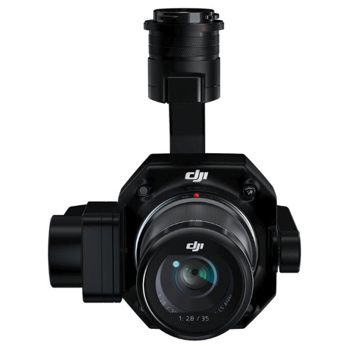
heliguy™ in-house surveyor, Ben Sangster, said: "The P1 (pictured above)has become a firm favourite for aerial surveyors and it is easy to see why when looking at the 3D model.
"Drone mapping, especially with the M300 RTK and P1, is an efficient method of data collection and the survey in Alnwick demonstrated how drones can be utilised for conservation."
Emma Gledson, from the Estates, added: "The on-site survey was carried out in a short space of time and with great professionalism at all times.
"The data is and going to prove invaluable moving forward with monitoring and maintaining the Scheduled Monument, which unfortunately is prone to vehicle impact damage due to being located on a main vehicular route through Alnwick town centre.”
To add the P1 to your fleet or to discuss starting or scaling your drone surveying programme, speak to heliguy™'s in-house GIS specialists. Also find out about heliguy™'s dedicated P1 workflow training to help you maximise data capture and the creation of digital datasets. Contact us.

Leave a comment