
"The DJI Phantom 4 RTK is a good survey tool that can yield high accuracy."
This is the verdict of Terra Drone Europe (formerly Skeye), after testing the performance of the next-gen mapping drone.
The leading industrial inspection company has been using the DJI Phantom 4 RTK at a number of its sites across the world and has produced an accuracy report exclusively for heliguy™.
Terra Drone Europe's key findings reveal:
- In most cases, the accuracies that can be achieved without any ground control points (GCPs) are less than 3-4cm. This is a great time saver!
- In other workflows, using four GCPs are recommended. This is still a reduction in the amount of GCPs needed, compared to traditional surveying methods.
- The RTK (real-time kinematic) works 'extremely well'.
- The smallish pixel size of the Phantom 4 RTK's camera isn't ideal for low-lighting conditions.
- The Phantom 4 RTK is 'best-suited' for smaller survey areas (< 50ha).
To examine the accuracy of the drone, Terra Drone Europe carried out a number of tests on two different sites, with the results published in this blog post. Use the summary below to click straight through to one of the sections in this report.
- The Drone
- Background
- Methodology
- Site One
- Use of all (nine) GCPs
- Use of four ground control points and RTK flight positions
- Use of no ground control points and only RTK flight positions
- Volume Comparison
- Difference Grids
- Conclusion - Site One
- Site Two
- Use of all (11) Ground Control Points
- Use of four ground control points and RTK flight positions
- Use of no ground control points and only RTK flight positions
- Volume Comparison
- Difference Grids
- Conclusion - Site Two
- Conclusion
heliguy™ has previously published an accuracy report compiled by DroneDeploy, which further endorses the reliability and effectiveness of the Phantom 4 RTK.
KEY FINDING: In most cases, the accuracies that can be achieved without any ground control points are less than 3-4cm
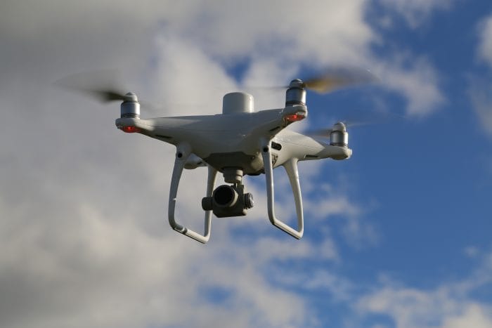
The Drone
The DJI Phantom 4 RTK was released in October 2018. The drone was designed to use RTK processing to produce highly accurate aerial maps.

In addition to the RTK unit, the Phantom 4 RTK also uses a redundant GNSS (Global Navigation Satellite System) module that provides additional flight stability when flying in dense regions with poor RTK signal.
DJI claims 1cm RTK horizontal positioning accuracy and 1.5cm RTK vertical positioning accuracy. In terms of absolute measurements on photogrammetric models, DJI claims 5cm accuracy when flying at 100 meters with 2.7cm GSD (Ground Sampling Distance).
The RTK module, pictured below, is integrated directly with the drone to provide centimetre-level accuracy for stable flight and accurately georeferenced imagery.

A new TimeSync system was added to continually align the flight controller, camera and RTK module – ensuring each photo uses the most accurate metadata and fixes the positioning data to the centre of the CMOS sensor.
KEY FINDING: The RTK works 'extremely well'
The Phantom 4 RTK also has the ability to connect to the D-RTK 2 Mobile Station (pictured below), NTRIP (Network Transport of RTCM via Internet Protocol), or store the satellite observation data to be used for PPK.

When Terra Drone Europe received the Phantom 4 RTK, we were challenged to test the accuracy of this device. The unique selling point of this drone is that it is able to record the exact set of coordinates at the moment of the image acquisition using RTK GNSS. This integrated system ensures that the coordinates are matched to the centre point of each image. Because the image location is well known it is possible to reduce the amount of ground control points needed in the field. This reduces the amount of time needed to be on site while maintaining the same level of accuracy.
Terra Drone Europe
Background
Terra Drone Europe is an aerial survey and inspection company utilising the latest unmanned aircraft with high precision cameras and survey equipment.
By taking a series of overlapping images from known locations it is possible to make very accurate measurements and even 3D models from still images. This is the science of photogrammetry.
KEY FINDING: In some workflows, using four GCPs are recommended. This is still a reduction compared to traditional methods
Once on site, the survey requires the creation of GCPs which are placed on the project site. These are clearly marked so that they will appear in the aerial images taken by the drone.
Usually these are marked by survey markers on the ground and are placed strategically across the site at a predefined spacing which is determined during the planning stage.

The centre point of each GCP is measured using a highly accurate Real-time Kinematic (RTK) GNSS receiver.
Creating a link between the centre point of each GCP in the drone images to exact X, Y, Z coordinates will ensure that the project is properly scaled and geo-referenced which allows the software to create valuable and accurate 3D models.
It is possible to create a number of products using this technique, such as:
- RGB coloured point clouds
- Textured 3D mesh models
- Digital Surface Models (DSM)
- Digital Terrain Models (DTM)
- Orthophoto mosaics
- Elevation contour lines
During the placement of the GCPs, an additional set of GNSS points are measured. These points will not be used during processing but are meant to verify the quality of the products.
The verification is done by comparing the elevation of these check points (CHPs) and the elevation of the coordinates in the products. Additionally, the horizontal error is calculated by comparing the placement of the GCPs in the orthophoto. With these results it is possible to determine the final
accuracy of the project.
KEY FINDING: The smallish pixel size of the Phantom 4 RTK's camera isn't ideal for low-lighting conditions
It is important to measure sufficient check points that are well distributed across the project site to get a statistically correct and meaningful indication of the achieved accuracy.
Most photogrammetric data-processing packages give an indication of the achieved accuracy but in practice it can be observed that these figures are usually too optimistic when compared to measured check points.
Methodology
In order to evaluate the performance of the DJI Phantom 4 RTK, Terra Drone Europe conducted two surveys at two stockpile storage sites.
Terra Drone Europe undertakes stockpile volume checks on a weekly basis for a range of clients across the United Kingdom and the Netherlands and has many years of data to compare against.
KEY FINDING: The Phantom 4 RTK is 'best-suited' for smaller survey areas (< 50ha)
Three types of processing tests were performed at both locations:
- No RTK flight positions and using the full amount of available GCPs
- All RTK flight positions and 4 GCPs placed on the corners of the project site
- All RTK flight positions and no GCPs
The verification (check) points are meant to verify the absolute accuracy of the DJI Phantom 4 RTK. For an exact volume calculation, the following points are important:
- Should the volume be calculated relative to a level (imaginary) plane, such as a certain number of metres above sea level?
- Is the stockpile located on a flat or sloped ground floor?
- Should the stockpile be calculated relative to a second 3D model?
In the case of calculating volumes relative to another model, it is worth noting that because the second DSM has a fixed and absolute location it is important that the newly-created DSM matches it as closely as possible.
Any deviation between the data sets and the stockpile calculation will yield very different results.
KEY FINDING: The DJI Phantom 4 RTK is a good survey tool that can yield high accuracies
For the stockpiles measured in this test, existing ground models are used to ensure that the survey data is accurate. Ground models have been created through existing topographic survey data from each site which show all ground levels.

A final test that was performed was to create a difference grid. This newly-created grid shows the height difference between two data sets for each grid cell. An elevation colour scalebar was made to highlight areas of large deviation.
The Results
Site One
Location: The Netherlands.
Terrain: Flat terrain with one large stockpile.
Size of Site: 250 metres by 100 metres.
Material: Processed coal.
Weather: Stable with three metres per second wind and some clouds.
The figures below show the locations of each GCP and check point. A red dot indicates a GCP and a blue dot indicates a check point. Read on for the results of the flight data.


Use of all (nine) GCPs
Z accuracies: With nine GCPs and no RTK flight positions it is possible to achieve around a one centimetre standard deviation with respect to GNSS. The standard deviation (between the GPS and the ground model produced by the drone) was 0.013.
X,Y accuracies: The horizontal error on the orthomosaic averaged to around one centimetre deviation. The standard deviation was 0.011.
Use of four ground control points and RTK flight positions
Z accuracies: In this data set, Terra Drone Europe achieved similar results with only four GCPs and all of the RTK flight positions. The standard deviation was 0.010.
X,Y accuracies: When using less GCPs, the horizontal error only went up slightly. The standard deviation was 0.012.
Use of no ground control points and only RTK flight positions
Z accuracies: The RTK positions of the Phantom 4 were good enough to achieve centimetre results when no GCPs are used. The standard deviation was 0.013.
X,Y accuracies: When not using any GCPs, the average error goes up by only 0.3 centimetre. The standard deviation was 0.015.
Volume Comparison
Only a slight average difference of 0.01% between using four GCPs and no GCPs. However, due to the large size of this stockpile, the difference in cubic metres is considerable.
Difference Grids
By overlaying and subtracting one DSM from another DSM it is possible to produce a data set showing the relative differences between the two datasets. This data will highlight areas which show variation in the Z value.
Areas where there is a negative Z value will be shown in a shade of red while areas with a positive Z value difference will be shown in a shade of blue. Areas shown in grey show very little or no difference at all.
The scale bar shows a colour ramp with 5cm intervals.


Conclusion - Site One
Figures 4 and 5 show very little variation between data sets across the entire site. While this shows a difference in Z values, it also shows that the XY values are extremely consistent and match up well between data sets. There is a sign of noise in the data in the centre left of the site which is due the presence of a puddle of water.
For a flat project site like this, which is flown with a high overlap, the results from using no GCPs and only RTK flight positions is very comparable to having the site well covered with GCPs.
The X,Y & Z values showed a consistent standard deviation between the measured points and the processed data.
Site Two
Location: The United Kingdom.
Terrain: The ground floor is concrete, but uneven in areas as it slopes
and deviates around the site.
Size of Site: Around 300 metres long and 100 metres
wide and contains multiple stock piles.
Material: Several kinds of aggregates, stones and sand.
Weather: Stable with 4 metres per second wind and overcast.
The figures below shows the locations of each ground control point and check point. A red dot indicates a GCP and a blue dot indicates a check point. Read on for the results of the flight data.


Use of all (11) Ground Control Points
Z accuracies: The standard deviation on the check points was less than 2cm. The standard deviation was 0.015.
X,Y accuracies: The average error on the orthomosaic was less than 1cm. The standard deviation was 0.009.
Use of four ground control points and RTK flight positions
Z accuracies: When reducing the amount of GCPs from 11 to four, the deviation on the check points goes up as well. This indicates that the flight positions were overall less accurate than the ground control points. The standard deviation was 0.028.
X,Y accuracies: The average error goes up slightly when reducing the amount of GCPs. The vertical error is more pronounced than the horizontal error. The standard deviation was 0.012.
Use of no ground control points and only RTK flight positions
Z accuracies: Without any GCPs the deviation on the check points is more similar to using four GCPs. The standard deviation was 0.034.
X,Y accuracies: The horizontal error is less than 1.5cm which indicates that the flight positions have a similar amount of horizontal deviation. The standard deviation was 0.014.
Volume Comparison
When it comes to volume comparson, there was an average difference of 0.39%, between using four GCPs and no GCPs.
Difference Grids


Conclusion - Site Two
At site two, a slight deviation between the surface models can be observed.
The most likely reason for this difference is that with less GCPs the importance of accurate flight position goes up.
And when these positions are not as reliable as the ground control points, the result is a small shift on the model.
This effect is more pronounced when no GCPs are used to geo-reference the project.
It is also more difficult for the photogrammetry software to calculate an accurate focal length of the camera lens when no ground reference is used. An inaccurate focal length results mostly in a difference in the Z-axis.
Conclusion
Having collected all of the data and analysing the results, Terra Drone Europe has come to this conclusion:
The DJI Phantom 4 RTK shows good results. In most cases, the accuracies that can be achieved without any GCPs are less than 3-4cm. For a lot of projects this would be accurate enough.

When in need of even higher accuracies, the RTK flight positions are a good photogrammetric support of a well distributed network of GCPs.
In the situation of calculating stockpile volumes it is advisable to use at least four GCPs to support the software to calculating accurate camera parameters.
With large stockpiles, a small difference in height of only a few centimetres can result in very large differences in volume. By using GCPs, the software has more certainty in calculating an accurate camera focal length value.
The Phantom 4 RTK has a one-inch sensor with a pixel size of 0.00241 millimetres (2.41 microns). Due to this small pixel size, the performance in low-lighting conditions when surveying are not ideal as the camera has to increase the ISO value. This makes the photos grainier and more noisy which increases the amount of noise in the processed point cloud.

Flying at a lower altitude helps with picking up finer details in the photos which increases the quality of the photo alignment. However, the lower flying altitude ultimately slows flight speeds and limits the potential coverage, making the P4 RTK effective over smaller sites but far less efficient for larger drone surveying and mapping projects.
While the feature of having accurate RTK based flight positions does help with creating accurate 3D models with less GCPs, it is still crucial to measure independent check points across the project site to verify the results of the final products. Without any check points it is not possible to filter out any human or computer errors that could have occurred during processing.
It is important to note that a good processing workflow helps to ensure consistent results. This is especially useful when having to compare 3D models of the same site over a period of time.
Small tweaks in the processing can yield very different results, therefore using a workflow to keep the results consistent regardless of the processor is highly recommended.

The DJI Phantom 4 RTK is a good survey tool that can yield high accuracies. However, when performing high accuracy photogrammetry, like stockpile calculations, we do recommend that it is used in combination with at least four ground control points.
Not having any ground control points is possible but makes the end result a slight bit less accurate. In addition, a number of verification points are also needed to perform quality control of the final products. If you are measuring verification points, then a few extra ground control points will ensure the highest accuracies and best end results.
Our main conclusion on the use of the DJI Phantom 4 RTK is that the positioning part (i.e. the RTK) works extremely well but due to the small sensor that it is best suited for smaller survey areas (< 50 ha) and good lightning conditions.

Leave a comment