

An award win, new release game-changing drones and updated regulations - 2018
With 2019 on the horizon, this special blog post reflects on the past 12 months, reminiscing on the launch of popular products such as DJI's Osmo Pocket and Mavic Air, industry big-hitters like the Mavic 2 Enterprise and Phantom 4 RTK, and the proud moment when heliguy™ received a prestigious prize at the North Tyneside Business Awards.
2018 at a glance
![]()
DJI Mavic Air ![]()
DJI Phantom 4 V2.0 ![]()
DJI Phantom 4 RTK ![]()
DJI Mavic 2 Enterprise (Zoom and Dual) ![]()
Emergency Services Roadshow ![]()
heliguy™ wins award ![]()
DJI Mavic 2 Zoom and Pro ![]()
DJI Osmo Pocket


JANUARY
DJI began 2018 as it meant to go on - with the release of an array of new UAVs and other state-of-the-art kit. Indeed, the year certainly began with a bang, with the curtain coming up on the Mavic Air, Tello, Osmo Mobile 2 and the Ronin-S.
Ryze Tello
DJI teamed up with drone startup, Ryze Robotics, to create the intelligent mini-drone, the Tello.
Dubbed the most fun drone ever, this affordable flyer is suitable for children and adults and the perfect gift for new pilots. It made its official debut at the CES conference in Las Vegas.
Key Features

- Perform awesome tricks with just a tap of the screen, including 8D flips
- Flight time of up to 13 minutes
- High-quality image processor shoots incredible photographs and video
- Weighs just 80g
- Start flying by throwing Tello into the air
- Two antennas make video transmission extra stable
- The super-safe Tello can be used indoors and outdoors
DJI Mavic Air
Under the tagline, Adventure Unfolds, DJI released the much-anticipated Mavic Air - a small, portable and foldable drone capable of some big things.
Horizontal, Vertical and 180° Panoramas can be captured, as well as 32MP Sphere Panoramas, which stitch together up to 25 photos in just eight seconds. The Mavic Air also lets you capture ultra-high definition video in 4K at 30fps and 100Mbps or slow-motion in 1080p at 120fps.
There is also an array of intelligent flight modes, such as ActiveTrack (sense up to 16 subjects simultaneously, letting you choose the best tracking scenario) and SmartCapture (hand launch and control the Mavic Air).
Thanks to FlightAutonomy 2.0, the Mavic Air is also capable of 3D map building (create a real-time 3D map for improving flight safety) and Advanced Pilot Assistance Systems, which help the drone to actively avoid obstacles when flying forward or backwards.
Key features

- Foldable design
- Up to a 21-minutes of flight time
- Speeds of up to 42.5mph
- 1/2.3 CMOS sensor and a new Image Signal Processor
- Gesture control including SmartCapture
- Three-axis gimbal
- 4K video at 30fps and 12MP stills
- 32MP Sphere Panoramas
- Three-direction obstacle avoidance at the front, rear and bottom
- Visual Positioning System for increased accuracy when hovering
DJI Ronin-S
Featuring stabilisation technology, the Ronin-S is designed for DSLRs and mirrorless cameras. It provides precision control, advance stabilisation and manual focus control. Shoot shake-free and smooth video with an incredible cinematic and professional feel.
The gimbal has been designed to ensure the display of the camera isn’t blocked to maintain complete control over the camera when using upright and underslung.
The Ronin-S is compatible with a wide range of DSLRs and mirrorless camera with camera control. This includes Sony, Nikon, Canon and many more.
Key features

- Features a DJI Focus Wheel for precise control over compatible cameras
- Elevates the camera creating an unobscured shot in both upright and underslung shots
- SmoothTrack allows easy shot and subject transition for all set types
- Three modes are available, including a Sport Mode for fast-paced shots
- Simple and easy to use interface that allows quick changes in modes
- Mount the Ronin-S on a telescopic pole or RC buggy for flexibility in your shots
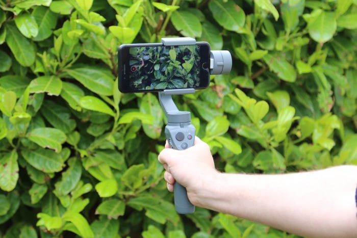
DJI Osmo Mobile 2
The Osmo Mobile 2 is a handheld gimbal for smartphones, giving stabilised images and video in a lightweight and portable package.
The Osmo Mobile 2 has a significantly improved battery time and simplified controls to that of the original Osmo Mobile. It helps users capture smooth and cinematic shots with their smartphone with the help of Intelligent Modes, such as ActiveTrack and Panorama.
The three-axis gimbal cancels out three directions of movement including handshaking and tremble to give the highest quality results.
The Osmo Mobile 2 is compatible with smartphones from 58.6-84.8mm wide and up to 8.4mm thick. This covers the majority of smartphones from Apple and Android. The Osmo Mobile 2 communicates with smartphones via Bluetooth.
Key features
- Intelligent Modes include ActiveTrack, Motionlapse, Hyperlapse Slow-mo, Zoom Control and Timelapse
- Shoot for up to 15 hours
- Osmo Mobile 2 charges your smartphone battery
- ¼” universal screw for mounting on standard accessories
- Upload and live stream straight to social media through the DJI GO app
- Pivot between landscape and portrait modes
- Extremely lightweight
- Control camera settings with the Osmo’s handle
MARCH
If February was a quiet month on the new release front, DJI made up for it in March by unveiling two products for the Enterprise market; the Zenmuse XT2 and a new Payload SDK (Software Development Kit) for the Matrice 200 Series. These products were announced at an event in Menlo Park fire department headquarters in California.
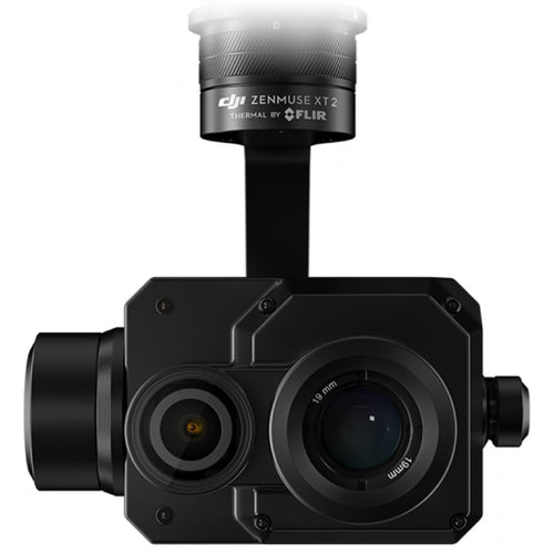
Zenmuse XT2
The Zenmuse XT2 from DJI and
The Zenmuse XT2 is available for use in a variety of different applications, including firefighting, search and rescue, hazardous material investigation, roof inspection, solar panel inspection and agriculture.
The XT2 features dual 4K, 12MP, 1/1.7″ CMOS visual sensor and FLIR Tau 2 thermal sensor. An IP44 rating allows the XT2 to be used is a wide range of weather conditions.
The Zenmuse XT2 is compatible with the following DJI drones:
- Matrice 200
- Matrice 210
- Matrice 210 RTK
- Matrice 600 Pro
The Zenmuse XT2 is available in 12 variants, with different lens sizes, resolutions and thermal frame rates. For more details, click here.
Key features
The Zenmuse XT2 features a wealth of intelligent modes to increase the efficiency and reliability of each mission. The following features are available:

Temperature Alarms: Notifications when temperatures exceed your configured limits
Heat Tracking: Quickly locates the hottest object in view
FLIR MSX: Overlay the thermal and visual data
Real-Time Temperature Check: Accurate real-time temperature warnings
Quick Track: Only tracking a desired object
Isotherms: Focus on a specific temperature band
PiP Options: Configure your desired picture in picture options while in flight
Payload SDK
In addition to announcing the new Zenmuse XT2, DJI also announced a new Payload SDK (Software Development Kit) for the Matrice 200 Series.
This was a really significant moment as it opened up the DJI ecosystem to a whole host of new third-party payloads. The availability to use third-party components opens DJI’s platforms to unlimited possibilities.

The Payload SDK is comprised of four different areas:
- Communication APIs: New protocols allow the payload to communicate with the internal systems on the Matrice 200 Series drone. This includes the remote controller, GPS, transmission and more.
- DJI SKYPORT: The adapter for the M200 Series to allow secure mounting of various payloads. SKYPORT allows communication between the drone and payload.
- External Payload: Various payloads from electromagnetic, robotic and much more can be installed on the M200 Series drone.
- Mobile App: Access real-time data, control your equipment, control settings and much more through a custom-built or DJI Pilot app.
At the time of the announcement, two company payloads were compatible with the new Payload SDK. These were
APRIL
At this year’s NAB show in Las Vegas, DJI announced two advanced gimbal controls for high-end cinematography; the DJI Master Wheels and DJI Force Pro. Both products are designed to offer precision control at a professional level.
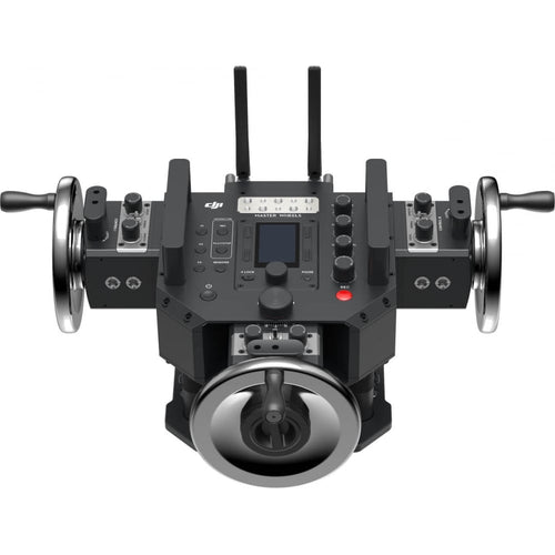
Master Wheels
The DJI Master Wheels are designed to give professional cinematographers ultimate control of their film set. The wheel-based system allows precise and repeatable shots to be captured with ease.
The Master Wheels are made from weighted stainless steel to offer perfectly stabilised and balanced control. The modules can be manually manoeuvred to suit the needs of each individual user. This allows for the most ergonomic design that doesn’t limit users to a set design, ideal when demands are high.
For even greater personalisation, the Master Wheels feature 1/4-20 and 3/8-16 taps, a CAN BUS port and a Mitchell mount with a baseplate for a huge range of uses. This allows professional cinematographers to mount a
Key features

- Advance algorithms, optical encoders and highly-sensitive sensors result in accurate shots every time
- Dual-band transmission in 2.4 and 5.8 GHz
- Latency as low as 10 milliseconds can be achieved
- Battery (TB50) self-heating function
- The modular setup allows complete adaptability
- Master Wheels feature 1/4-20 and 3/8-16 taps, Mitchell Mount and a CAN BUS port
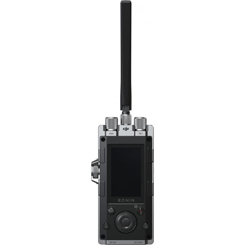
Force Pro
The DJI Force Pro is an advanced gimbal controller which synchronises the movement of the Force Pro on your gimbal. Made for high-end filmmakers to capture advanced shots with extreme precision.
Key features

- Advanced IMU and built-in compass for precise replicated movement
- Latency as low as 10 milliseconds
- Dual-frequency in 2.4 and 5.8 GHz to accurate wireless transmission
- Built-in screen, dials and buttons for extensive controls
- Up to five hours of battery life with USB-C port or CAN BUS port charging
- Freedom to mount accessories, transmission systems and monitors as well as options to mount on dedicated handles or various rigs including a tripod
Aerial Photography Workshop
At the end of April, heliguy™, in partnership with DJI, put on an aerial photography and videography event for new and experienced drone pilots. The event took place at the stunning Elvetham Hotel just outside Farnborough, one of Heliguy’s PfCO training locations.

Heliguy's Scott Henderson (pictured above), as well as two guest speakers, gave
The event attracted positive feedback from attendees, which included:
Fantastic day, really informative. Hope there will be more in the future. Well worth coming despite the long drive.
Will Wright
I thought it was a really good event and glad I was able to attend… Content and speakers were excellent, good balance of creative insight, tech knowledge/tips
Shariff Moossun
MAY
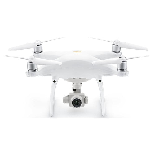
May was a big month for drone fans, as DJI released the latest member of their iconic Phantom family - the DJI Phantom 4 Pro V2.0. On top of this, DJI announced a ground-breaking partnership with Microsoft.
DJI Phantom 4 Pro V2.0
The Phantom 4 V2.0 features an OcuSync HD transmission system for dual frequency band switching. A powerful 1-inch Exmor R CMOS sensor captures high-quality images at 20 MP and video in up to 4K at 60 FPS.

The DJI Phantom 4 Pro V2.0 features a dual-band OcuSync transmission system, automatically switching between 2.4GHz and 5.8GHz. The controller identifies which frequency has the lowest interference and switch to provide the clearest transmission.
The Phantom 4 Pro+ V2.0 remote controller is available with a built-in 5.5” 1080p screen. The ultra-bright screen has a brightness of 1000 cd/m2, increasing usability in direct sunlight.
The remote
Key features

• Intelligent Flight Modes including ActiveTrack, Gesture Mode, TapFly and many more
• 1-inch 20-megapixel CMOS sensor capable of up to 4K video with a bitrate of 100Mbps
• A mechanical shutter, eliminating rolling shutter distortion
• Up to 30 minutes of flight time
• Five directions of obstacle sensing and four directions obstacle avoidance
• OcuSync transmission system
• Quieter propulsion system
DJI and Microsoft Partnership
At this year’s Microsoft Build conference in Seattle, a one-of-a-kind partnership was announced between drone giants, DJI and Microsoft. This alliance brings together DJI’s drone platforms and Microsoft’s AI and machine-learning technology for enterprise businesses.
As part of the partnership, DJI will be releasing an SDK (Software Development Kit) specifically for use with Windows. Using the SDK, Windows 10 PCs will be able to control and customise DJI drones for a huge number of applications.
JULY
July was an important month for drone users, as the Department for Transport announced a new set of laws for UAVs. Coming in two waves, the first began at the end of July 2018, while the second will come into effect towards the end of 2019. Aside from this, DJI unveiled the Enterprise Shield - a customisable drone-protection service.
New drone laws
The Department for Transport announced a set of new drone laws for UK drone pilots. These were:
As of the end of July 2018, drones are banned from exceeding 400 feet and flying within 1 kilometre of airport boundaries. People who break these new laws may face an unlimited fine and/or up to five years in prison.
Coming into effect from November 30, 2019, owners of drones weighing 250 grams or more will have to register their drone with the CAA and complete an online safety test. Drone pilots who fail to register and
Industry-changing CAA announcement for PfCo holders
The CAA announced some news for existing Small Unmanned Aircraft (SUA) Operators. From the end of July 2018, the following changes came into effect:
- A reduction on the classes of SUA from 4 to 2; 0-20kg Multirotor and 0-20kg Fixed Wing
- A standard PfCO now permits the operation of a 7-20kg SUA in congested areas to within 50m which previously SUA in such class were limited to a distance of 150m
- Night operations will be automatically granted providing the procedures for night operations are detailed within the applicant’s Operations Manual
For SUA Operators with an existing Permission for Commercial Operation (PfCO), these new changes will not come into effect until they renewed their existing permissions.
DJI Enterprise Shield
DJI announced the DJI Enterprise Shield, a new customisable drone-protection service plan designed to meet the diverse needs of today’s commercial drone operators.
DJI Enterprise Shield is the first comprehensive coverage plan of its kind that covers DJI’s line of enterprise products, providing broad accident coverage, repair and replacement services, free shipping and rapid delivery, and the option to share coverage across a fleet of enterprise products.
DJI Enterprise Shield is available in two tiers and protects a variety of DJI Enterprise products including the Matrice 200 Series drones and the Zenmuse Z30, X4S, X5S, XT and XT2 payloads. It provides coverage for one year from activation and covers a broad range of situations including those caused by pilot error, signal interference and water damage.
Geofencing flexibility
DJI announced a huge improvement to their geofencing system for authorised enterprise drone pilots. A new and efficient process is available to select pilots who have the authorisation to fly in sensitive areas, in which geofencing unlock codes will be available within 30 minutes thanks to DJI’s staff who will be working around the clock.
This development is ideal for the high demands of enterprise users that are often subject to time constraints.
AUGUST
August saw another industry-changing amendment to the Air Navigation Order 2016. There was also the eagerly-anticipated launch of two new additions to DJI's Mavic Series - the Mavic 2 Pro and the Mavic 2 Zoom. Meanwhile, heliguy™ headed to Blackpool Airport to hold a special event dedicated to drone detection by showcasing DJI AeroScope.
DJI Mavic 2 Pro and Zoom
The announcement of the Mavic 2 Pro and Mavic 2 Zoom took place at DJI’s See the Bigger Picture event in New York. These two new quadcopters share the unique foldable design of the Mavic Pro and add a wealth of new features and two powerful new cameras.
Mavic 2 Pro features

The Mavic 2 Pro features a Hasselblad camera with a one-inch CMOS sensor capable of 20MP images and 4K UHD.
An adjustable aperture of f/2.8 – f/11 allows users to have more creative control over their shots, choosing their own style and to capture the highest-quality images and video at the most demanding times, sunrise and sunset.
The Mavic 2 Pro has access to 10-bit Dlog-M colour profile and 10-bit HDR video, giving more flexibility in post-production and editing.
The Mavic 2 Pro has a huge ISO range with the max ISO lifted from 3200 to 12800.
Mavic 2 Zoom features

The Mavic 2 Zoom includes a 1/2.3 inch CMOS sensor capable of 12-megapixel and 4K UHD images with up to 4x zoom, including a 2x optical zoom (24–48 mm) letting you get closer to the action whilst maintaining a safe distance.
An advanced automated focus gives accurate and reliable focusing that’s 40% faster than ever before, even when zooming in and out.
Unique to the Mavic 2 Zoom is a new QuickShot Mode, Dolly Zoom. This feature will zoom into a subject whilst the Mavic 2 flies away, creating an intense warping effect.
Mavic 2 Pro and Zoom shared features

The Mavic 2 Pro and Zoom are the most advanced drones from the Mavic Series and DJI’s consumer range to date. Below are some of the key features shared by both drones:
- 31-Minute Battery: Each drone feature a huge battery life of up to 31-minutes.
- 72kph Speeds: Reducing the drag by 19%, the Mavic 2 drones are some of DJI’s fastest drones to date.
- OcuSync 2.0: Utilising DJI’s standout transmission system, OcuSync which has been upgraded for the Mavic 2. This allows a huge range of up to 8km and video transmission in 1080p. The Mavic 2 will also automatically switch between 204 and 5.8 GHz.
- Omnidirectional Sensors: The Mavic 2 Series is DJI’s safest drone to date with obstacle sensing in every direction.
- 8GB Built-In Memory: Like the DJI Mavic Air, the Mavic 2 feature 8GB built-in memory meaning you’ll never be stuck without space.
- Enhanced HDR Images: Get the best result on every shot utilising DJI’s HDR. This will automatically blend the images for the highest-quality images.
-
H.265 Codec: Detail and quality
is maintained using the advanced H.265 compression.
Intelligent Flight Modes:
Hyperlapse
HyperLight
QuickShots
APAS
ActiveTrack 2.0
Panoramas
DJI AeroScope demonstration
heliguy™ held an event at Blackpool Airport to demo the fixed and portable DJI AeroScope drone-detection models in real-world scenarios. heliguy™ is an AeroScope specialist.

The DJI AeroScope system is a sophisticated and comprehensive platform that rapidly identifies UAV communication links, gathering real-time information such as flight status, paths, serial number, speed, direction and
This monitoring data stream helps AeroScope users make an informed response and security decision as soon as possible.
There are two types of AeroScope unit – Stationary and Portable.
Stationary AeroScope Unit

The Stationary AeroScope unit is designed to be in continuous use outdoors and has an IP65 Ingress Protection.
One of the most significant advantages of using the Stationary unit is the ability to customise and configure the unit precisely to the site that needs to be monitored.
In ideal conditions, a Stationary AeroScope setup has a range of 50km - and can identify drones in a little as two seconds.
There are a number of deployment options too, meaning the data gathered by AeroScope can be hosted on a private cloud for particularly sensitive airspace.
It also allows you to integrate with other security systems to provide a more complete picture of the monitored airspace.
The Stationary DJI AeroScope provides a flexible platform for drone detection.
There are two antenna configuration options available. These are:
- G8 Antenna
- G16 Antenna
Both antennas are directional, but the higher gain G16 antenna provides the highest gain.
The Stationary AeroScope is water-proofed, dust-proofed and can be used in a huge range of temperatures and humidity levels.
Portable AeroScope Unit

The Portable AeroScope unit can be set up quickly and easily anywhere it's needed.
It's perfect for use at temporary events, mobile deployments or other instances where you need to protect the airspace around you at short notice.
This system gives you all the AeroScope functionality in a single portable case. The antenna, control screen and TB50 batteries, which power the unit, are all integrated.
In emergencies, the AeroScope Portable system can boot up almost immediately.
CAA releases Air Navigation Order amendment
The CAA released information on another industry-changing amendment to the Air Navigation Order 2016, entitled Small Unmanned Aircraft – Night Operations and Operations within Congested Areas by SUA Operators holding Permissions issued prior to July 30, 2018.
This change update allows any SUA operator with permissions from the CAA granted on or before the 30/07/2018 to operate at night and over or within 150 metres of a congested area.
Several conditions must be met in order to apply to these new articles. These include the following:
- The permission applies to the CAA standard permission that’s currently in place. It replaces any statement that limits operation to daylight as well as replacing any statement that prevents operation in a congested area.
- The permission is not applicable to operators who have an OSC (Operating Safety Case) in place. Original permissions or exemptions will apply in these cases.
- Night operation must be detailed within the operators Operations Manual with processes followed. Before night flights, a daylight reconnaissance and site assessment must take place. This should include the identification of aircraft flight paths and detail all hazards, restrictions and obstacles. VLOS must be maintained and the takeoff and landing point should have adequate lighting.
- A copy of the permission should be retained with the original permission.
- The permission has effect from its signage date until the 29/07/2019.
SEPTEMBER
September was a fairly quiet month, although there was news of a new partnership, while heliguy™ showcased some drones to a number of police forces.
New partnership
heliguy™ partnered with Drone AG to offer a two-day training course for using your drone on your farm.
Showcasing drones
The heliguy™ team was with Essex, Kent and Norfolk Police, showcasing the capabilities of the DJI Matrice 210, DJI XT2 and Z30. heliguy™ also showcased the new DJI Mavic 2 Pro and Zoom.
OCTOBER
If September was quiet, then October was busy, busy, busy, with the announcement of two major enterprise products from DJI - the Mavic 2 Enterprise and the Phantom 4 RTK.
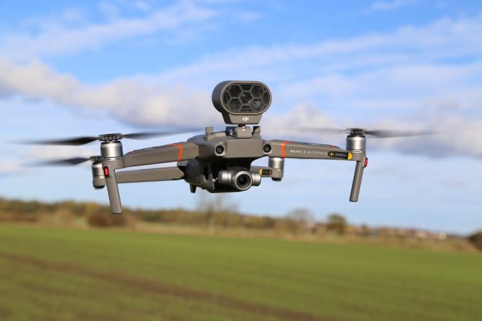
DJI Mavic 2 Enterprise
The Mavic 2 Enterprise has been designed with public safety, inspection, search and rescue, fire response and law enforcement in mind.
Possibly the jewel in the crown of the Mavic 2 Enterprise is its accessories, which can be securely mounted to the drone’s body. These accessories open new paths for pilots to communicate and work from the air, moving drones beyond imaging tools and into configurable platforms that enhance mission productivity. The accessories are:
Spotlight


A dual spotlight with a brightness of 2,400 lumens aids operators in carrying out missions in dark or low-light areas. Spotlight is ideal for search and rescue as well as inspection applications.
Speaker


A loudspeaker with a maximum projection of 100 decibels (1-meter distance) lets pilots play up to 10 custom voice recordings on demand, providing a communications channel to nearby individuals that can be critical during life-saving emergency operations.
Beacon

Designed with US Federal Aviation Administration Night Waiver standards in mind, the Beacon features a bright flashing strobe visible three miles away. This helps pilots carry out missions in low-light conditions or at night much more safely, and provides additional airspace awareness for operators of nearby drones and traditional aircraft.
Aside from the accessories, the Mavic 2 Enterprise has numerous strings to its bow. These include a password-protect system which is needed to take off or to access the 24GB
Other highlights include DJI AirSense, which enhances your airspace safety by giving you instant real-time positioning alerts on nearby manned aircraft, while the Advanced Pilot Assistance System enables the drone to detect objects on its every move, letting you easily fly around or over obstacles.
Key features

- Compatible with loud speaker, dual spotlight and beacon
- Weighs just 905g, foldable and easy to carry
- Self-heating batteries
- Over 30mins flight time
- 24GB of internal storage
- 2x optical, 3x digital zoom camera
- Password protection
- Compatible with numerous apps, including DJI Pilot and DJI FlightHub.
DJI Phantom 4 RTK
The Phantom 4 RTK provides a new standard for drone accuracy while requiring fewer ground-control points.
A new RTK module is integrated directly into the drone, providing real-time,

Just how accurate?
- 1cm+1ppm RTK Horizontal Positioning Accuracy
- 1.5cm+1ppm RTK Vertical Positioning Accuracy
- 5cm Absolute Horizontal Accuracy of Photogrammetric Models
This is on par with some of the most advanced equipment available, but in a much easier to use, lower priced, compact and more reliable package.
The Phantom 4 RTK has a one-inch, 20 megapixel CMOS sensor, while the mechanical shutter makes mapping missions or regular data capture seamless as the Phantom 4 RTK can move while taking pictures without the risk of rolling shutter blur.
Due to the high resolution, the drone can achieve a Ground Sample Distance (GSD) of 2.74cm at 100 meters flight altitude. Enjoy stable and reliable HD image and video transmission at distances of up to 7km, great for mapping larger sites.

Support your missions with the D-RTK 2 Mobile Station – providing real-time differential data to the drone and forming an accurate surveying solution.
The Phantom 4 RTK can also be fitted to NTRIP (Network Transport of RTCM via Internet Protocol) using a 4G dongle or WiFi hotspot, or store the satellite observation data to be used for PPK.
Key features

- Fewer ground-control points needed for accurate data collection
- D-RTK2 mobile station, providing accurate results in areas with bad mobile coverage
- Up to 30 minutes of flight time
- Integrated flight-planning app
- Flight will automatically resume after battery change
- Supports RTK and PPK
TB50 and TB55 battery issue
A number of incidents, with reports that a small amount of TB50 and TB55 batteries had shown incorrect power levels, leading to loss of power mid-flight. It impacted the DJI Matrice 200 Series and the DJI Inspire 2.
NOVEMBER
November was a very successful month for heliguy™, which included hosting an emergency-services roadshow, taking part in the ground-breaking Operation Zenith demonstration and winning a prize at the North Tyneside Business Awards. Elsewhere, there was an update on the TB50/55 battery issue and the conclusion of DJI's annual AirWorks Conference. Oh, and there was the small matter of DJI releasing the much-anticipated Osmo Pocket, which proved to be an incredibly popular product.
heliguy™ an award-winner
heliguy™ won a prestigious prize at the renowned North Tyneside Business Awards 2018, thanks to the company’s outstanding customer service and passion to develop the drone industry.
The North Shields-based UAV expert was presented with the Retail and Service Provider Award at last night’s ceremony, staged at the recently revamped Spanish City, in Whitley Bay.
heliguy™ beat the other shortlisted finalists – NBT Group, in Killingworth, and

Emergency Services Roadshow
heliguy™ held an Emergency Services Roadshow in Lincoln. The

The roadshow, at Waddington Training Site, was attended by 50 emergency-services personnel – including representatives from almost half of the UK’s police forces, as well as a decent number of fire and rescue, mountain rescue and RNLI crews – who learned more about the Mavic 2 Enterprise and were given the chance to see it in action during a number of live-action scenarios.
During the event, keynote speakers from Wiltshire, Lincoln and Devon and Cornwall Police forces spoke about how they are using drones to save lives, fight crime and keep their communities safe.
DJI praised Heliguy's running of the roadshow, describing the event as slick and well-managed.
Operation Zenith
heliguy™ was a key delivery partner in a world-first demonstration to test how drones and traditional aircraft can safely share the same airspace.
The ground-breaking live-action scenarios were staged at Manchester Airport to offer a glimpse into ‘a new and exciting future’ of air-traffic management.
Codenamed Operation Zenith, the special event was led by aviation technology company Altitude Angel, as well as Manchester Airport and NATS. The event was supported by a series of government, industry and academic participants, including DJI, Vodafone, the National Police Air Service, DEFRA and North East England-based heliguy™.
Eight demonstrations showcasing drones working in conjunction with traditional aircraft movements were played out at the airport and live-streamed to specially-invited guests at the Royal Aeronautical Society, in London.
The event has been described as the first steps towards understanding some of the challenges and solutions of integrating drones into controlled airspace.
heliguy™ was specially selected to support Chinese technology giant DJI with its AeroScope remote identification technology, which was used during Operation Zenith to demonstrate how it can be a key element in

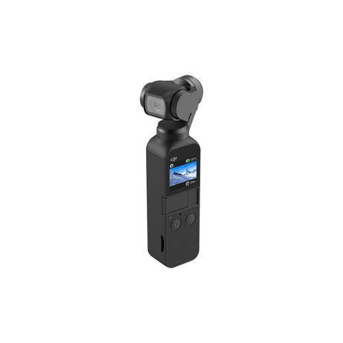
DJI Osmo Pocket
The DJI Osmo Pocket is a tiny, stabilised vlogging camera which offers storytelling freedom in the palm of your hand.
The Osmo Pocket boasts the smallest three-axis gimbal in DJI history, the ability to capture shake-free footage and a ½.3-inch sensor.
Your creative freedom can be taken further thanks to the dedicated DJI Mimo app, which boasts editing tools, templates and access to a content-sharing community that inspires your own visual storytelling.
The Osmo Pocket packs a range of exciting features. These are:
First Person View mode follows the gimbal's orientation to film thrilling action shots with smooth results.
Just tap on a subject and ActiveTrack intelligently follows. Entering Selfie mode automatically launches FaceTrack, keeping you in the centre of the picture.
For breathtaking vistas and landscapes, a 3×3 Panorama captures your destination with breathtaking definition and detail.
To squeeze a beautiful day into a single shot, Timelapse turns hours into seconds, and Motionlapse adds smooth camera movement for dramatic effect.
Osmo Pocket automatically detects and illuminates low-lit scenes into bright photos. You can also take tripod-free, 2-3s handheld long exposure shots in Pro mode.
Key accessories are available to expand your creativity, such as a waterproof case which allows the Osmo Pocket to go to depths of up to 60m for smooth underwater shots, detailed close-ups and clear low-light detail.
Key features

- DJI’s smallest three-axis mechanical handheld gimbal
- 1/2.3-inch sensor, 80° FOV and f/2.0 aperture
- Shoot 4K/60fps video at 100Mbps and photos at 12 MP with a pixel size of 1.55 μm
- Battery life of more than two hours
- Range of intelligent functions, including 3x3 Panorama, NightShot, Motionlapse and ActiveTrack
- Dedicated DJI Mimo app featuring editing tools, templates and access to a content-sharing community
AirWorks Conference 2018
The biggest event of its kind, the 2018 showcase was staged at the Hilton Anatole Hotel, Dallas, Texas, from October 30, to November 1, attracting hundreds of guests and an array of specially-selected key-note speakers.
The theme of this year’s conference was Empowering the Ecosystem, and DJI certainly flexed its muscles, unveiling new products and software and highlighting its commitment to innovation, especially within the enterprise sector.
There were also fascinating case studies about how drones are changing the world in which we live and, in some cases, making a difference between life and death.
Here are 10 things were learnt from the 2018 conference.
DJI Mavic 2 Enterprise
This small and compact drone, which is a modified version of the popular Mavic 2, focuses very much on enterprise, with a particular emphasis on the way it can transform the day-to-day operations of emergency service and rescue personnel.
DJI Flight Simulator
The DJI Flight Simulator is a ground-breaking pilot-training solution, providing an accessible, intuitive and realistic learning experience.
According to DJI, the Flight Simulator sets a new standard for drone-pilot training, paving a new path for the next generation of drone pilots.
Developed with enterprise in mind, this useful training tool creates the most realistic simulated flight experience, allowing pilots to hone their skills without the risks and costs associated with real-life training.
This state-of-the-art training simulator has multiple flight modes, training modules and point of views, as well as a comprehensive physics engine
DJI Pilot
One of the big pieces of news at the AirWorks Conference was that DJI’s software solution, DJI Pilot, is now officially out of beta. This was greeted warmly by the audience. It is available for Android and Apple’s iOS. New features include a mission-planning feature for mapping or inspection work.
The software will be rolled out over DJI’s entire product portfolio, including the Zenmuse XT2, payload SDKs and the Mavic 2 Enterprise. It is also fully-integrated with FlightHub. DJI has also increased data security by adding password protection.
DJI Ground Station Pro Enterprise
The DJI GS Pro is an iPad app designed to control or plan automatic flights for DJI aircraft. Now, DJI has announced the new DJI GS Pro Enterprise. With the new features, you can conduct automated flight missions, manage flight data on the cloud and collaborate across projects to efficiently run your drone programme.
SDK and the power of five
DJI admitted that it was surprised by the strong growth in SDK activations, but the company has embraced this by developing five different types of SDK. Currently, DJI offers Mobile SDK; UX SDK; Onboard SDK; Payload SDK; and Windows SDK.
The huge rise in demand for SDKs was demonstrated by the activation numbers for Mobile SDK, which have climbed from 150,000 in 2015 to 4.7million in 2018.
The Microsoft DJI Windows SDK brings real-time AI and machine learning capabilities to imagery from DJI drones – exponentially increasing the ways in which drones can be used and scaled for enterprise applications.
DJI Manifold 2
DJI Manifold 2 allows your drone to process data on board the aircraft. The Manifold 2 houses impressive processing power, similar to what is found in self-driving cars.
DJI Terra
DJI Terra is a 2D and 3D mapping solution to help users and developers digitise the world. It will be available in early 2019 and pricing will be made public at a later stage.
Plane inspection
DJI and American Airlines presented a demonstration to showcase how drones can be used to carry out aircraft inspections.
Using the new DJI Mavic Enterprise, the drone was flown around an American Airlines plane to highlight how UAVs can make the inspection easier and save huge amounts of time and money.
For the sake of the demonstration, the Mavic Enterprise located a small sticker acting as a fault on the plane. The drone then zoomed in and around the supposed fault to showcase how it would work in a real-life setting, outlining how the drone could capture up-close imaging of the problem and transfer that data back for a team to analyse on the ground.
Drones for good
Drones have helped to rescue at least 196 people around the world. This incredible statistic was announced during AirWorks 2018. And after listening to various key-note speakers, it is clear that UAVs are playing a crucial role within the emergency services and other sectors.
Chief McNeal, of Twain Harte Fire Station, spoke about how he integrates UAVs into his fire and disaster response and training in order to keep First Responders safer and more knowledgeable in dangerous burn areas. He explained how drone technology is the next leap forward for firefighting.
Officer Barry Moore showed how a drone spotted a potential ambush of police officers and allowed Mansfield Police to resolve the situation quickly, without any violent conflict.
Drone industry like the ‘beginnings of the PC market’
Jan Gasparic, DJI’s Director of Strategic Partnerships, said that the AirWorks mission was to ‘build a global ecosystem for aerial productivity’.
He then likened the current state of the drone industry to where the PC market was at the beginning of its development.
He said: “The drone industry is in the same place now the personal computer industry was 30 or 40 years ago.”
This statement indicates that DJI is preparing for the future and is planning for the continued expansion of the drone industry.
DJI issues firmware update
DJI issued firmware updates for users of TB50 and TB55
The updates enhanced the battery-management system and optimise power supply during flight. The firmware update addressed what DJI said was ‘a rare issue involving the battery state of charge calculation algorithm’.
Beta phase of QEP
DJI unveiled the beta phase of its Qualified Entities Programme (QEP),
Through the QEP, DJI removed all domestic geofencing limitations and altitude limitations for enterprise aircraft, allowing users to fly in sensitive locations and at higher altitudes, in order to enable critical operations such as disaster response, firefighting, search and rescue and other public-safety applications.
CAA consultation
The CAA launched a consultation to find out how people are using drones.
The feedback will allow the CAA to build the Drones Registration Service - designed to meet drone-user requirements. All drone pilots and operators with aircraft weighing 250g or more will need to register from November 2019.
DECEMBER
The final month of 2018 was a lively one, with the release of the DJI Mavic 2 Enterprise Dual and the UK’s first drone delivery over a 4G mobile network, while the need for airports to have drone-detection technology was thrust into the spotlight.
DJI Mavic 2 Enterprise Dual
DJI released the Mavic 2 Enterprise Dual – a portable industrial drone equipped with powerful, side-by-side visual and thermal cameras that provide commercial pilots

Developed in partnership with FLIR Systems, the Mavic 2 Enterprise Dual features the compact design of DJI’s Mavic 2 Series drones with the same array of advanced controls and accessories found in the Mavic 2 Enterprise.
The Mavic 2 Enterprise Dual allows users to measure temperatures and conveniently store images and temperature data for efficient reporting and analysis, adding immediate value to a range of industrial or time-sensitive operations, from utility inspections to emergency response.
Mavic 2 Enterprise Dual features a three-axis gimbal stabilised camera housing a side-by-side 4K sensor for capturing visible light and a FLIR Lepton thermal microcamera for capturing thermal data.
Together, these sensors allow pilots to perform flights at night, as well as fly in complex daytime conditions like fog and smoke. Users can select from multiple intelligent display modes in the DJI Pilot flight control app to visualise data from the dual-sensor camera. These are:

FLIR MSX: Combine visible and thermal images in real time.
Spot Meter: Monitor and measure temperatures.
Area Measurement: Oversee temperature measurements on specific areas.
Isotherm: Get accurate heat measurements on a variety of objects and scenarios, such as searching for people and enhancing image visibility for improved situational awareness.
Other highlights of the Mavic 2 Enterprise Dual include the fact that you can attach the Mavic 2 Enterprise's beacon, loudspeaker or spotlight to enhance missions.


Key features

- Visible and thermal imaging
- Multiple Display Modes, such as FLIR MSX and Infrared
- Attach speaker, spotlight and beacon accessories
- 24GB on-board storage
- Password protection
- Up to 31 minutes of flight time
- Top speed of 72kph
- Self-heating batteries helps the drone perform in temperatures as low as -10 Celsius
- Benefits from DJI’s AirSense technology and
Ocusync 2.0 - providing a safer flight and stable connection
New partnership
heliguy™ entered into a strategic partnering agreement with Survey Solutions Scotland – the sole UK distributor for Delair UAV fixed-wing products – to offer clients the long-range, BVLOS-ready Delair UX11.

This state-of-the-art UAV is a professional aircraft suitable for large-area mapping, with BVLOS (beyond visual line of sight)-ready
After agreeing the partnership, heliguy™ invited the Iris Group to its test site in Northumberland to showcase the Delair UX11. Iris is looking for a fixed-wing solution for a major project – with high-accuracy requirements – in the Middle East.
It was the first joint demonstration under the new partnership between heliguy™ and Survey Solutions Scotland and both companies are excited about working together.
Key features of Delair UX11

- Cover 2.1km² (520 acres) with 1.7cm GSD (ground sample distance) at 122m flight height. The UX11, with a flight time of up to 59 minutes, has an industrial camera with optional PPK activation. Advanced features include in-flight photo viewing, quality assessment and adjustment.
- Mobile connectivity via 3G network (4G-ready) for unlimited range. Can be used in conjunction with radio for redundancy.

- Following an intuitive inbuilt checklist, the UX11 is hand-launched. The UX11 can land accurately (5x5m area) and safely with its unique deep stall landing function.
- Easy-to-use Android mission planning and monitoring app – pre-flight checklist, no-fly zones, modern user interface, in-flight data review. Also, use Delar after-flight software (included) for PPK processing and to prepare raw data for any photogrammetry software.
Streamlined Operations Manual
Candidates sitting Heliguy’s Commercial Drone Operators Training (C-DOT) Course will now be able to complete the vital Operations Manual quicker and easier than ever before.
The new streamlined approach, unveiled by our dedicated training team, will shave many hours off the once time-consuming and complex process, meaning more flying and less typing.
It will make the task much less onerous for budding commercial drone pilots and deliver a much more hands-on learning experience.
And the end result – candidates will gain a thorough understanding of the document and leave with a personalised and tailored Operations Manual in a fraction of the time, standing them in good stead to apply to the Civil Aviation Authority (CAA) for their Permission for Commercial Operation (PfCO).
AeroScope available
heliguy™ stresses that the ground-breaking DJI AeroScope drone-detection technology is available to monitor and spot UAVs – which could potentially stop major incidents like the major disruption at Gatwick Airport just before Christmas.

The BBC contacted heliguy™ for an interview, in relation to drone detection, and came to film at heliguy™ HQ. Heliguy's Operations Manager, Scott Henderson, later appeared on the national BBC News, giving expert views on the benefits of DJI's AeroScope system.
heliguy™ launches HECTIC
heliguy™ unveiled HECTIC - a new design and development service by heliguy™, creating bespoke items and offering custom solutions for commercial drone applications.
With many years of experience and expertise in the UAV industry, Heliguy's dedicated and knowledgeable technicians have launched this invaluable consultancy to provide tailor-made products and hardware and software integrations.
HECTIC - which stands for heliguy™ Electronics and Custom Technology Integration Centre - is Heliguy's specialised research and development arm, which can be used to turn people’s ideas into reality. So, if you have a solution to a problem in mind, but do not know how to produce it, that’s where HECTIC comes in.
Click here to find out more about what HECTIC can do for you.
Further firmware updates
DJI released new firmware updates for users of TB50 and TB55 batteries, to address the small number of reports of Matrice 200 Series drones experiencing early Return-to-Home or Automatic Landing.
DJI said that these cases are not due to product performance issues, but are false alarms triggered by conservative measures DJI implemented in November to prevent any further potential of M200 series drones experiencing loss of power mid-flight.
DJI said that this new firmware update (v01.02.0301) further improves the algorithm accuracy of the battery-management system to enhance
Flexible insurance policies
The company, which offers specialist drone insurance cover for commercial and recreational users, introduced the new
Highlights include:
- Free flight training cover for clients going through any flight examination with any NQE within the UK
- Free registration system for commercial users
- Annual policy now available for recreational drone users
- Coverdrone FlySafe app is now free to all
Vodafone achieves UK first
Vodafone completed the UK’s first drone delivery over a 4G mobile network.
The drone was the first of its kind to be built and flown in the UK and harnesses the power of Vodafone’s network via a portable 4G router.
In the future, drone delivery over a mobile network could be used to drop vital supplies into hard to reach places.
Drones are traditionally flown using a radio link, with the drone in sight of the operator. However, controlling drones using the 4G network means they can be monitored in real time, reducing the need for drones to be flown in line of sight.
The specially-adapted drone was made to look like a twinkling Santa sleigh and carried festive treats. It brought Christmas cheer to Portland Bill Coastwatch, which sits on one of the most southerly points of the UK and operates 365 days a year.
Drones a key part of Airspace Modernisation Strategy
It was announced that drones are a key consideration in a new Airspace Modernisation Strategy – a shared objective between the Civil Aviation Authority (CAA) and the Government for modernising and integrating UK airspace.
The document says that drones are just one example of an emerging technology that is fast becoming ubiquitous.

Leave a comment