
 LiDAR Case Study – 3D Mapping with Drones
Heliguy Insider recently got the opportunity to speak to Maria-Valasia Peppa, a Research Associate in Geomatics from Newcastle University’s School of Engineering and Ivona Hubova, a Systems Engineer from 3D Laser Mapping. Our interviews followed a heliguy™ enterprise handover for a DJI Matrice 600 Pro and LiDAR system supplied by 3D Laser Mapping, purchased by Newcastle University.
We had the opportunity to discuss LiDAR systems and their integration with drones along with the applications the technology could benefit.
Keep reading to find out more on LiDAR technology and for a chance to read our interview with Newcastle University and 3D Laser Mapping.
LiDAR Case Study – 3D Mapping with Drones
Heliguy Insider recently got the opportunity to speak to Maria-Valasia Peppa, a Research Associate in Geomatics from Newcastle University’s School of Engineering and Ivona Hubova, a Systems Engineer from 3D Laser Mapping. Our interviews followed a heliguy™ enterprise handover for a DJI Matrice 600 Pro and LiDAR system supplied by 3D Laser Mapping, purchased by Newcastle University.
We had the opportunity to discuss LiDAR systems and their integration with drones along with the applications the technology could benefit.
Keep reading to find out more on LiDAR technology and for a chance to read our interview with Newcastle University and 3D Laser Mapping.
 DJI M600 Pro with LiDAR
Interview with Newcastle University
We spoke to Maria Valasia Peppa from Newcastle University about their use of drone and their new LiDAR system. Can you start off by introducing yourself and giving us an overview of what you do? My name is Maria Valasia Peppa and I am a Research Associate in Geomatics, at Newcastle University. My main interest is to integrate geomatic data from various sources such as terrestrial/airborne laser scanning, GNSS and Total station, terrestrial and small unmanned aircraft (SUA)-based photogrammetry etc. I apply photogrammetric and computer vision techniques to real-world problems relating to the natural and built environment. I recently completed my PhD, with Newcastle University, focusing on landslide monitoring. The PhD aimed to investigate the potential of a consumer grade SUA to provide accurate time series of 3D landslide information in the absence of physically established control points. When did Newcastle University start using drones and how? The Geomatics Group of the School of Engineering at Newcastle University first purchased an SUA in 2012. As far as I know, they started using it in 2013 when I commenced my PhD. In particular, I used a consumer-grade fixed-wing aircraft that could carry a compact digital camera. This was fitted in the aircraft’s body in a way to capture close to Nadir RGB imagery. The acquired images were used to generate a 3D digital surface model of a landslide with the aid of Structure-from-Motion and Multi-View-Stereo image matching pipeline. After repeated SUA surveys, it was possible to estimate the horizontal and vertical surface movement and monitor the landslide’s kinematics. The same SUA was also used for another PhD project related to tree phenology monitoring.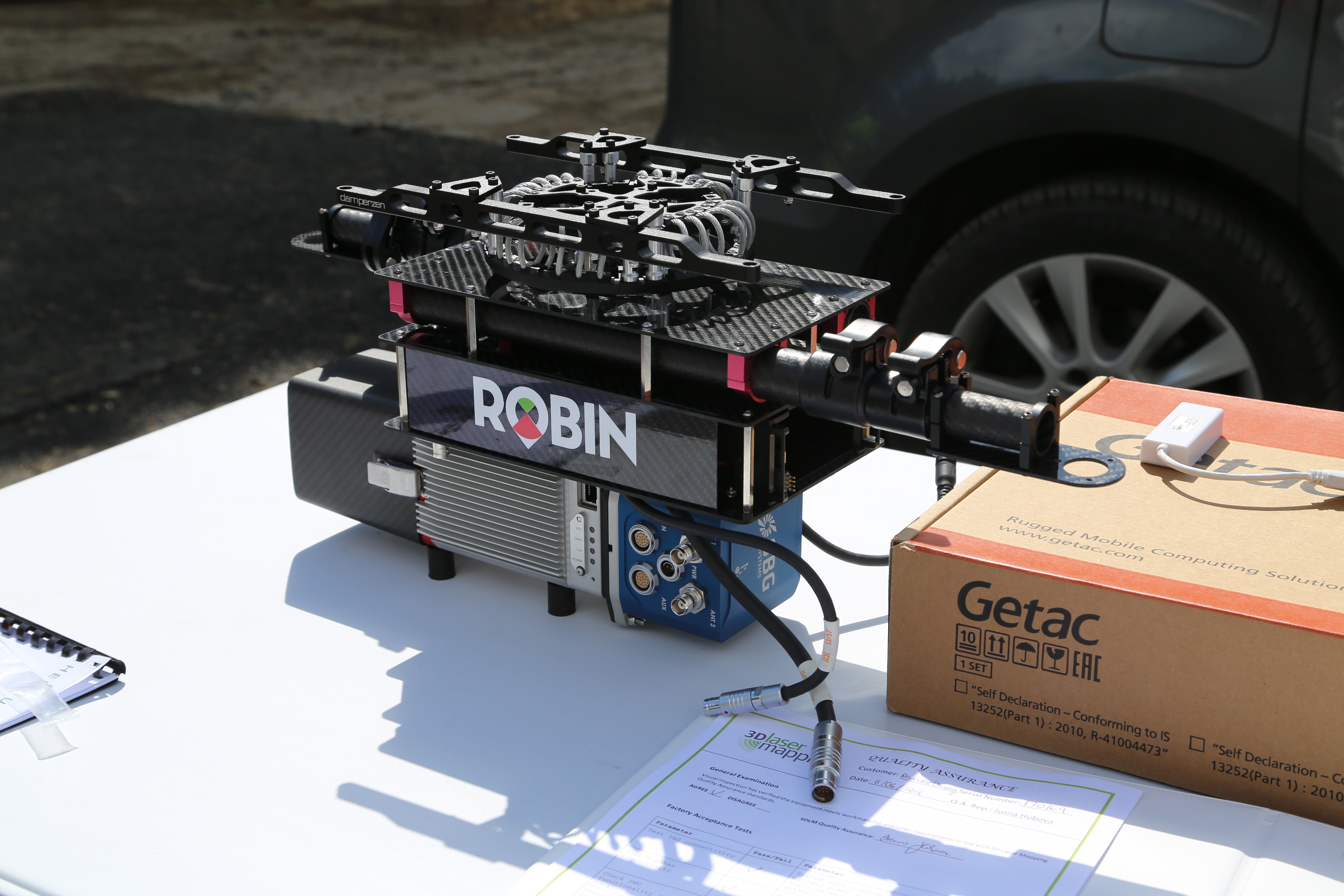 LiDAR System
Is that when you started flying drones?
Yes, that was actually my first time I ever flew a drone, in October 2013.
Why did you choose to use Lidar technology?
We have now chosen LiDAR technology because it can mainly capture underlying terrain, not feasible with aerial photogrammetry. As a result, high-density point clouds can be obtained across vegetated areas and used for the derivation of digital ground surface and canopy height models.
LiDAR System
Is that when you started flying drones?
Yes, that was actually my first time I ever flew a drone, in October 2013.
Why did you choose to use Lidar technology?
We have now chosen LiDAR technology because it can mainly capture underlying terrain, not feasible with aerial photogrammetry. As a result, high-density point clouds can be obtained across vegetated areas and used for the derivation of digital ground surface and canopy height models.
 heliguy™ with Newcastle University
What projects will you be using the LiDAR for?
Here, in geomatics group, we are planning to use a LiDAR system either mounted on an SUA or on a vehicle for a variety of projects, namely: landslide monitoring; erosion and deformation monitoring; biomass estimation; monitoring the health of trees; tree phenology monitoring; traffic flow monitoring, landscape evolution change close to cultural heritage sites and many other projects.
What were the original methods of capturing this data?
Before purchasing the LiDAR system that can be fixed on an SUA, we were collecting data mainly obtained with GNSS/ Total station, terrestrial and SUA-based photogrammetry as well as a terrestrial/airborne laser scanner. Point-based approaches (i.e. GNSS/Total station) offer lower spatial resolution than terrestrial and SUA-based approaches.
However, terrestrial-based approaches require numerous scanning positions in order to cover a larger study area and occlusions can occur in point clouds due to oblique incident angles.
heliguy™ with Newcastle University
What projects will you be using the LiDAR for?
Here, in geomatics group, we are planning to use a LiDAR system either mounted on an SUA or on a vehicle for a variety of projects, namely: landslide monitoring; erosion and deformation monitoring; biomass estimation; monitoring the health of trees; tree phenology monitoring; traffic flow monitoring, landscape evolution change close to cultural heritage sites and many other projects.
What were the original methods of capturing this data?
Before purchasing the LiDAR system that can be fixed on an SUA, we were collecting data mainly obtained with GNSS/ Total station, terrestrial and SUA-based photogrammetry as well as a terrestrial/airborne laser scanner. Point-based approaches (i.e. GNSS/Total station) offer lower spatial resolution than terrestrial and SUA-based approaches.
However, terrestrial-based approaches require numerous scanning positions in order to cover a larger study area and occlusions can occur in point clouds due to oblique incident angles.
 3D Laser Mapping's Ivona and Newcastle University
What are the benefits of using drones for data collection?
Drones or SUAs can provide a time-efficient and cost-effective approach for geomatics data collection, especially for topographic surveys and monitoring studies. An SUA can be set up and launched at very short notice, allowing for multiple flights per day.
It can also fly autonomously with the help of pre-defined flight paths. Data can be acquired from low altitudes without being limited by cloudy conditions, as opposed to manned photogrammetric surveys. Unlike terrestrial-based approaches, an SUA can collect observations over a large study area.
Depending on the payload capability, various sensors can be mounted on an SUA. For example a LiDAR alongside a compact digital RGB camera or a multispectral/hyperspectral together with an RGB camera, enabling an integration of heterogeneous observations.
Are there any limitations to using drones?
The time of flight, which depends on the battery life and performance, can limit the area covered during an SUA survey. Hence, it is crucial to keep the batteries in the best condition when not flying, use them correctly with care and monitor their status during a flight.
The effective operational range of an SUA in combination with the maximum visual distances between the pilot and the aircraft can also constrain the study area of a survey. Based on UK regulations the maximum visual distances are 500m (1640ft) horizontally and 120m (400ft) vertically. The pilot should be aware of the effective operational range of its own SUA (usually depended on the manufacturer) and ensure that any loss of communication would not result in an incident that could threaten the safety of other airspace users or third parties.
Moreover, unfavourable weather conditions such as high winds, rain, snow and drizzle can adversely affect the quality of photogrammetric and LiDAR observations when acquired with SUAs.
3D Laser Mapping's Ivona and Newcastle University
What are the benefits of using drones for data collection?
Drones or SUAs can provide a time-efficient and cost-effective approach for geomatics data collection, especially for topographic surveys and monitoring studies. An SUA can be set up and launched at very short notice, allowing for multiple flights per day.
It can also fly autonomously with the help of pre-defined flight paths. Data can be acquired from low altitudes without being limited by cloudy conditions, as opposed to manned photogrammetric surveys. Unlike terrestrial-based approaches, an SUA can collect observations over a large study area.
Depending on the payload capability, various sensors can be mounted on an SUA. For example a LiDAR alongside a compact digital RGB camera or a multispectral/hyperspectral together with an RGB camera, enabling an integration of heterogeneous observations.
Are there any limitations to using drones?
The time of flight, which depends on the battery life and performance, can limit the area covered during an SUA survey. Hence, it is crucial to keep the batteries in the best condition when not flying, use them correctly with care and monitor their status during a flight.
The effective operational range of an SUA in combination with the maximum visual distances between the pilot and the aircraft can also constrain the study area of a survey. Based on UK regulations the maximum visual distances are 500m (1640ft) horizontally and 120m (400ft) vertically. The pilot should be aware of the effective operational range of its own SUA (usually depended on the manufacturer) and ensure that any loss of communication would not result in an incident that could threaten the safety of other airspace users or third parties.
Moreover, unfavourable weather conditions such as high winds, rain, snow and drizzle can adversely affect the quality of photogrammetric and LiDAR observations when acquired with SUAs.
 DJI M600 Pro with LiDAR
What is your opinion of the UK regulations?
UK legislation for SUAs operation seems relatively complex as it's included in different legal documents. This can often make their interpretation quite difficult. However, UK regulations cover important health and safety considerations that ensure safe SUAs operations for both commercial and recreational purposes.
What would you say to someone interested in using drones in a similar field?
SUAs or drones can complement conventional topographic surveys and support the production of digital 3D models of high spatiotemporal resolution with a time-efficient way. They can also be a cost-effective solution for monitoring applications across hazardous areas that can be either dangerous or inaccessible.
However, everyone interested in using SUAs in similar fields must understand and comply with the UK regulations.
They should also take into consideration that an SUA cannot always guarantee the same levels of a 3D positional absolute accuracy that conventional surveying can deliver. Understanding all errors associated with the miniature consumer-grade sensors mounted on SUAs will benefit the interpretation of acquired observations.
It is also recommended to cross-validate SUA products using benchmark observations obtained with conventional geomatics techniques, as this can assess the accuracy delivered with SUA surveys.
What support have heliguy™ provided you with?
Firstly, heliguy™ helped our Geomatics Group to choose and purchase the SUAs that are suitable for the group’s current and forthcoming research projects. The heliguy™ employees have shown high expertise and great willingness to design mounting solutions of different sensor payloads.
Heliguy have also provided a comprehensive full training course for CAA approved commercial pilot of an SUA. During the course, the heliguy™ team unravelled the complex UK regulations in a simple and easy way to enhance our understanding.
The heliguy™ head office is located at the Tyne Tunnel Trading Estate, very close to Newcastle University which is very convenient for a continuous fruitful future collaboration.
DJI M600 Pro with LiDAR
What is your opinion of the UK regulations?
UK legislation for SUAs operation seems relatively complex as it's included in different legal documents. This can often make their interpretation quite difficult. However, UK regulations cover important health and safety considerations that ensure safe SUAs operations for both commercial and recreational purposes.
What would you say to someone interested in using drones in a similar field?
SUAs or drones can complement conventional topographic surveys and support the production of digital 3D models of high spatiotemporal resolution with a time-efficient way. They can also be a cost-effective solution for monitoring applications across hazardous areas that can be either dangerous or inaccessible.
However, everyone interested in using SUAs in similar fields must understand and comply with the UK regulations.
They should also take into consideration that an SUA cannot always guarantee the same levels of a 3D positional absolute accuracy that conventional surveying can deliver. Understanding all errors associated with the miniature consumer-grade sensors mounted on SUAs will benefit the interpretation of acquired observations.
It is also recommended to cross-validate SUA products using benchmark observations obtained with conventional geomatics techniques, as this can assess the accuracy delivered with SUA surveys.
What support have heliguy™ provided you with?
Firstly, heliguy™ helped our Geomatics Group to choose and purchase the SUAs that are suitable for the group’s current and forthcoming research projects. The heliguy™ employees have shown high expertise and great willingness to design mounting solutions of different sensor payloads.
Heliguy have also provided a comprehensive full training course for CAA approved commercial pilot of an SUA. During the course, the heliguy™ team unravelled the complex UK regulations in a simple and easy way to enhance our understanding.
The heliguy™ head office is located at the Tyne Tunnel Trading Estate, very close to Newcastle University which is very convenient for a continuous fruitful future collaboration.
 heliguy™ with Newcastle University
Thank you to Maria from Newcastle University for taking the time to speak to us about the university's use of drones.
heliguy™ with Newcastle University
Thank you to Maria from Newcastle University for taking the time to speak to us about the university's use of drones.
heliguy™ Team Receive Award from Newcastle University
The heliguy™ Team are proud to announce following their work with Newcastle University, they received an award as part of the Excellent Supplier Awards – 2018. The award was delivered by the Director Estate Support Service Head of Procurement was for Heliguy’s contribution to student experience. Newcastle University Award Ceremony
Newcastle University gratefully acknowledges the funding received by the Engineering and Physical Sciences Research Council (EPSRC) award EP/R010102/1: UKCRIC - UK Collaboratorium for Research in Infrastructure & Cities: Newcastle Laboratories.
What is LiDAR?
LiDAR (Light Detection and Ranging) is a sensing technology that utilises light waves from a pulsing laser to capture minute measurements. These measurements can then be used to create detailed 3D maps and models for a variety of different applications. A LiDAR system calculates the time between the laser leaving the system and how long it takes to be reflected back after it hits an object. These details are then used to calculate the distance between the system and the ground using the speed/velocity of light. A LiDAR system can send out around 1 million pulses a second, capturing huge amounts of detail in a short period of time. This helps provide accurate information on the subject. Traditionally, aerial LiDAR was mounted on helicopters, however, with the evolution of UAVs, drone LiDAR systems have gone through a huge expansion. This is due to the ease in transporting, deployment and the significantly lower price point. DJI M600 Pro with LiDAR
Applications of LiDAR
LiDAR technology can be used in a wide range of applications including the following areas:- Agriculture and forestry
- Archaeology
- Infrastructure Surveys
- Construction
- Resource surveying
heliguy™ Custom Build
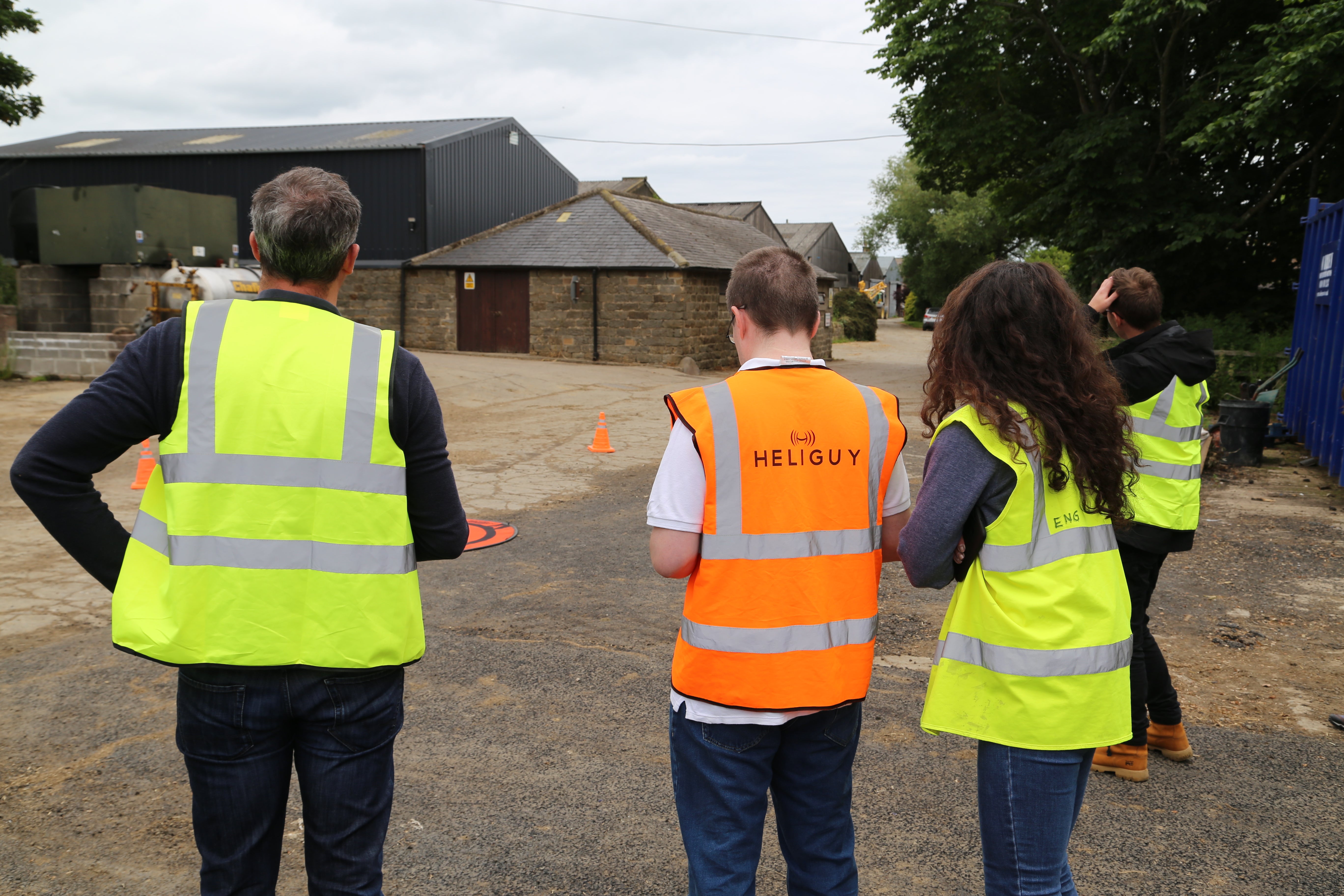
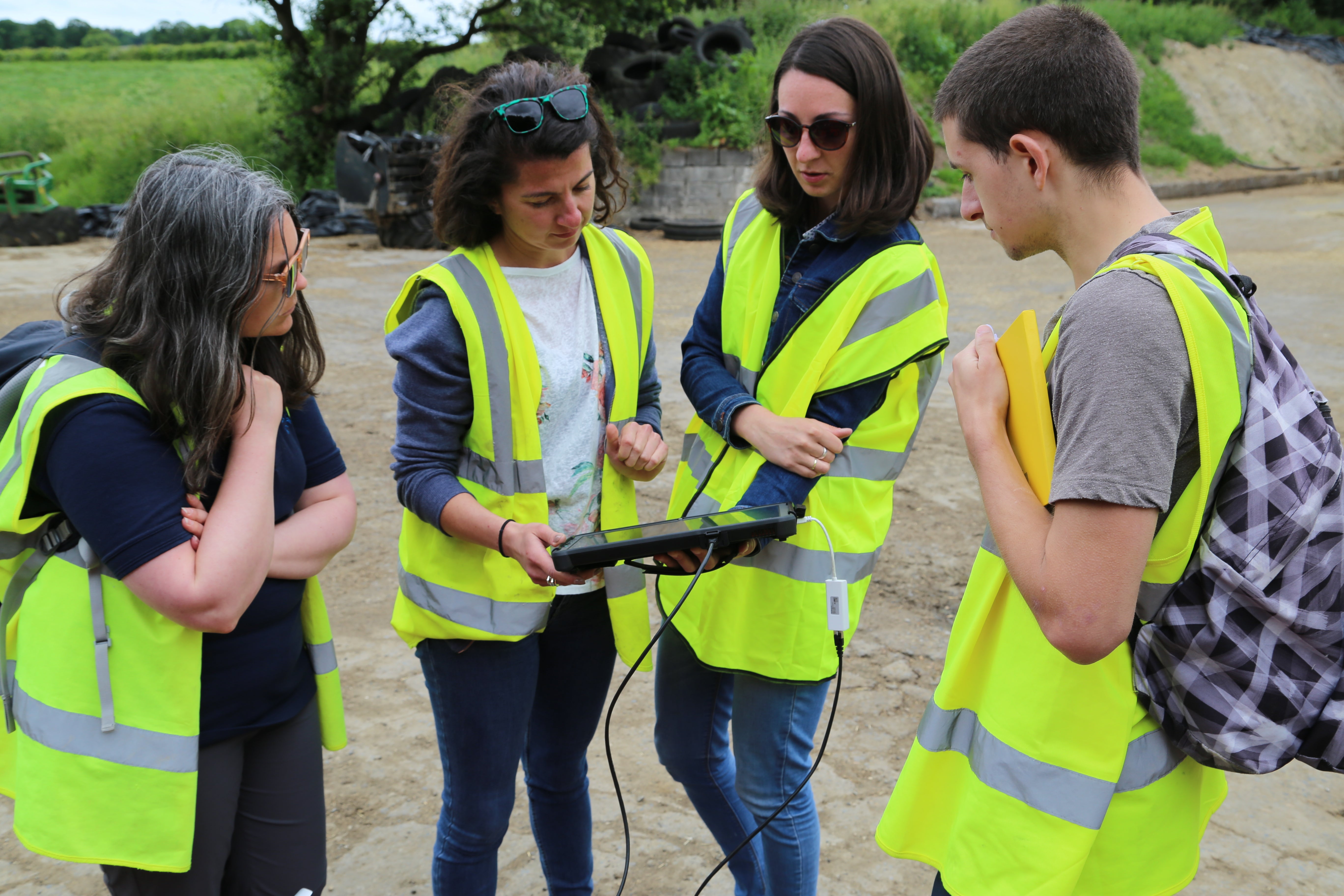
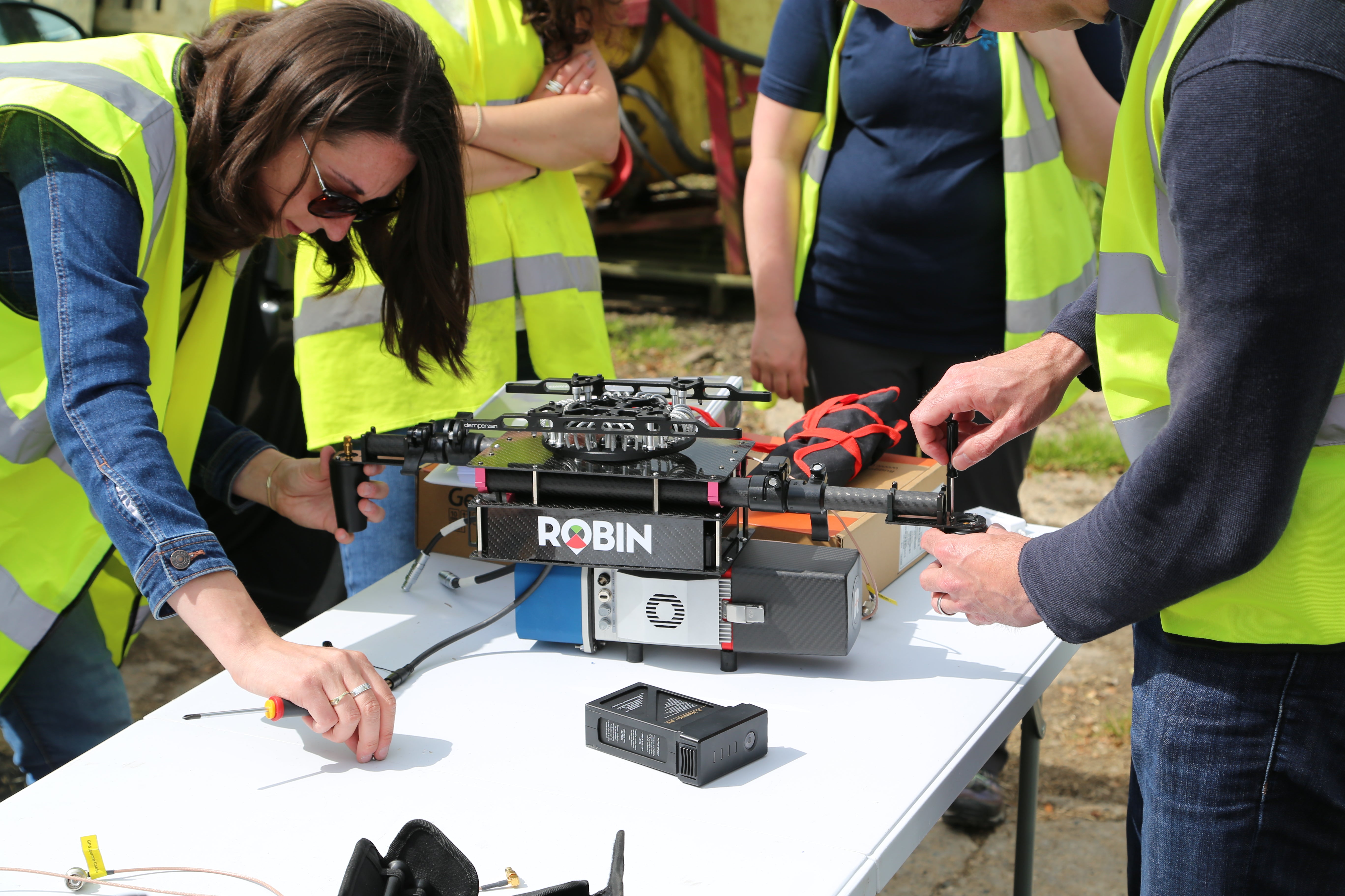
The heliguy™ Technical Team completed a custom-build for Newcastle University’s aerial LiDAR system. The build comprised of a DJI Matrice 600 Pro and dummy LiDAR system used to test the equipment. The M600 Pro was assembled and updated then fitted with the dummy LiDAR. The team then performed several test flights of the drone to ensure complete and expected functionality for the UAV with the custom mount. Following the Technical Team’s thorough testing, a heliguy™ Enterprise Handover was arranged with 3D Laser Mapping, who supplied the complete LiDAR system, and Newcastle University. At the handover, a further test flight was completed before the LiDAR system was installed. Once installed, the team completed a final test flight before handing over the drone and providing an in-depth demonstration of its proper use. heliguy™ with Newcastle University
Interview with 3D Laser Mapping
We spoke to Ivona Hubova from 3D Laser Mapping about LiDAR technology. Can you give us a brief overview of 3D Laser Mapping and your role? 3D Laser Mapping have been designing and integrating components into high-quality LiDAR scanners for over 19 years. LiDAR is used by a wide range of industries, helping businesses to understand and monitor the world around them. One of our systems, ROBIN, is the worlds first flexible mobile LiDAR scanner. The ROBIN can be used on a backpack, vehicle, UAV or a helicopter/plane. I’m a LiDAR Systems Engineer and offer support and training to ROBIN customers globally. What industries benefit from an aerial LiDAR system like the ROBIN MINI LiDAR? ROBIN MINI has allowed us to scan and map places that would previously have been too difficult, too expensive or too unsafe to access. Adding ROBIN MINI to UAV platforms means we can now quickly and easily map within forest canopies, in large mines and densely populated urban environments. Because UAVs are quickly deployed, repeat scans are used to identify areas of change, for example, vegetation growth near powerlines or signs of coastal erosion. heliguy™ Enterprise Handover
How do drone-based aerial LiDAR systems compare to traditional ground and aerial methods?
UAV or Near Ground Earth Observation LiDAR scanning is a fast way to collect data compared to traditional ground capture methods. There is less atmosphere between the UAV and ground that can have negative effects on both the LiDAR data and GNSS solution when compared to airborne.
Multirotor UAVs can fly as high/low and as fast/slow as the survey requires, whilst they capture very high-density point clouds, so long as it’s in accordance with CAA permissions.
What are the benefits of using LiDAR systems?
LiDAR solutions from 3D Laser Mapping mean data can be collected quickly, with very high accuracy, across multiple terrains and environments.
In particular, LiDAR data capture compared to other methods means:
heliguy™ Enterprise Handover
How do drone-based aerial LiDAR systems compare to traditional ground and aerial methods?
UAV or Near Ground Earth Observation LiDAR scanning is a fast way to collect data compared to traditional ground capture methods. There is less atmosphere between the UAV and ground that can have negative effects on both the LiDAR data and GNSS solution when compared to airborne.
Multirotor UAVs can fly as high/low and as fast/slow as the survey requires, whilst they capture very high-density point clouds, so long as it’s in accordance with CAA permissions.
What are the benefits of using LiDAR systems?
LiDAR solutions from 3D Laser Mapping mean data can be collected quickly, with very high accuracy, across multiple terrains and environments.
In particular, LiDAR data capture compared to other methods means:
- Precise geometric measurements
- It can be used at night and in dark environments because it’s an active sensor
- Successful data capture isn’t affected by cloud cover or dense forestry canopies, something photogrammetry is limited by
- It can penetrate dense vegetation
- It’s great for ground surface models
 3D Laser Mapping Mounting LiDAR
What levels of data accuracy can be achieved when using an aerial LiDAR system and how can these be maximised?
The accuracy of the data depends on several factors: GNSS errors, due to satellite coverage, satellite geometry and atmospheric and satellite timing errors can have the biggest impact on the accuracy of the final data.
Absolute point cloud positioning accuracy for ROBIN MINI is typically 5cm (real world, all errors inclusive practical figure). Using Ground Control Points makes it possible to improve the accuracy.
From a recent UAV test flight with ROBIN MINI, 6mm average dz value was achieved.
What advice would you give someone looking to integrate a LiDAR system into their business?
Do it! Talk to us about your project and what you’re looking to achieve, we have a team of UAV specialists and can give you a good idea if LiDAR is right for you.
The breadth of uses for LiDAR is so wide, it can help a huge range of business to understand and plan for changes. We’re working on a range of projects at the moment, spanning archaeology, railways, power and pipeline mapping, oil rigs, pylons, cities and road networks.
How did you find working with heliguy™ on this integration?
Both Paddy and Kevin were amazing, they were patient and professional and I am looking forward to working on projects together soon.
3D Laser Mapping Mounting LiDAR
What levels of data accuracy can be achieved when using an aerial LiDAR system and how can these be maximised?
The accuracy of the data depends on several factors: GNSS errors, due to satellite coverage, satellite geometry and atmospheric and satellite timing errors can have the biggest impact on the accuracy of the final data.
Absolute point cloud positioning accuracy for ROBIN MINI is typically 5cm (real world, all errors inclusive practical figure). Using Ground Control Points makes it possible to improve the accuracy.
From a recent UAV test flight with ROBIN MINI, 6mm average dz value was achieved.
What advice would you give someone looking to integrate a LiDAR system into their business?
Do it! Talk to us about your project and what you’re looking to achieve, we have a team of UAV specialists and can give you a good idea if LiDAR is right for you.
The breadth of uses for LiDAR is so wide, it can help a huge range of business to understand and plan for changes. We’re working on a range of projects at the moment, spanning archaeology, railways, power and pipeline mapping, oil rigs, pylons, cities and road networks.
How did you find working with heliguy™ on this integration?
Both Paddy and Kevin were amazing, they were patient and professional and I am looking forward to working on projects together soon.
 DJI M600 Pro with LiDAR
How do you think LiDAR and drone technology will improve in the future?
Sensors are getting smaller and more powerful – until recently, scanners would use a very low scan speed and it could take several days to complete a project. Now within 20 minutes of capture, we can often have all the data we need.
The use of LiDAR in self-driving cars will no doubt raise the profile of the industry, and new ways to use LiDAR will continue to be discovered
I hope we’ll see UAV LiDAR benefitting from sensor fusion – where high precision IMU systems are integrated as part of flight controllers. I’d also hope to see new sensor types, perhaps hyperspectral, multispectral and thermal will be amongst the first to be developed.
DJI M600 Pro with LiDAR
How do you think LiDAR and drone technology will improve in the future?
Sensors are getting smaller and more powerful – until recently, scanners would use a very low scan speed and it could take several days to complete a project. Now within 20 minutes of capture, we can often have all the data we need.
The use of LiDAR in self-driving cars will no doubt raise the profile of the industry, and new ways to use LiDAR will continue to be discovered
I hope we’ll see UAV LiDAR benefitting from sensor fusion – where high precision IMU systems are integrated as part of flight controllers. I’d also hope to see new sensor types, perhaps hyperspectral, multispectral and thermal will be amongst the first to be developed.
Example Video of LiDAR Results
Check out the example of the LiDAR system in action:About the ROBIN MINI UAV LiDAR
The LiDAR system was provided by 3D Laser Mapping, a UK-based global supplier of mapping tools. They supplied the ROBIN MINI UAV LiDAR, a compact, light-weight LiDAR system specifically designed to be mounted on drones. The ROBIN MINI features a miniVUX-1UAV laser scanner, IMU and two GNSS antennas. This kit, along with optional extras such as the anti-vibration damper, weighs in at under 5kg. The ROBIN MINI gives a 360° field of view of up to and has a flight time of up to four hours, letting you capture a huge range of data. Please note - batteries on the drone will have to be changed as applicable.Are you interested in finding out more on an aerial LiDAR system? Give one of our team a call on 0191 296 1024.
Summary
The application of aerial LiDAR technology through the use of drones can clearly have some huge benefits for a range of industries. The technology is both time and cost-effective in delivering results and providing support to many applications. The work of Maria and the Geomatics Group at Newcastle University clearly shows the advantages a drone can give you, however, you need to make sure you have the support of a knowledgeable company to get the most out of your kit. Speak to one of Heliguy's expert team today for more information on how drones could benefit your industry.To discuss any information from the above post or any DJI or Freefly product, please give one of our team a call on 0191 296 1024 or email us at info@heliguy.com.
Keep checking back to Heliguy’s Insider Blog for more announcements, insights into drones and, of course, the latest news from the drone industry.

Leave a comment